Cedar Breaks National Monument
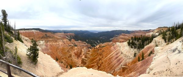
Some people may see a similarity between Cedar Breaks National Monument and Bryce Canyon. At more than 10,000 feet above sea level and with miles of painted cliffs, sure there are similarities.
But I think the colors of Cedar Breaks are much more intense than those visible in Ebenezer Bryce’s bowl. It may be the most colorful of all Utah parks and monuments.
A Great Summer Climate
Cedar Breaks National Monument has a marvelous summer climate due to the high altitude. When the deserts below are baking under intense heat, visitors enjoy delightful temperatures up above. Summer daytime temperatures average 60-70 degrees F (15.5-21 degrees C).
Afternoon and evening thunderstorms are common. July storm clouds can even bring a snow flurry to the area. On our last visit in early June a couple years ago, it was downright cool. The skies were overcast although the expected rain never fell.
At an early July family reunion in Cedar City several years ago, we spent several days sweltering in temperatures exceeding 100 degrees F (37.8 C). I had never been to Cedar Breaks National Monument but I knew it had to be better than what we were going through below.
Just 22 miles (35 km) up the canyon, we were met with invigorating temperatures in the 70’s F. What a refreshing contrast!
The high-altitude moisture of July brings gaudy wildflower displays to offset the jade-colored fir and spruce forests surrounding the monument.
A Giant Amphitheater
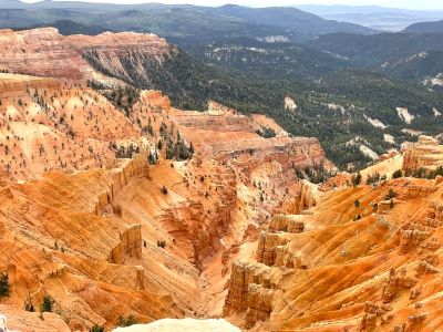
Cedar Breaks National Monument was established in 1933. It sits high atop the Markagunt Plateau at an elevation of more than 10,000 feet. It is a giant amphitheater stretching for 3 miles (4.8 km) and is more than 2000 feet deep!
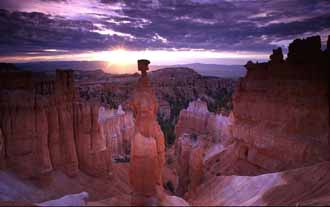
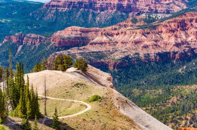
Native Americans called Cedar Breaks the "Circle of Painted Cliffs." Millions of years of uplift and erosion have exposed the limestone below. The result? A massive natural coliseum full of bluffs, hoodoos, ridges and canyons. And a magical array of colors.
More than fifty different shades have been identified in the Breaks. The cliffs look to be white or orange at the top. As your gaze moves down, you’ll see rose and coral. And coffee, lavender and yellow. Even purple.
A six-mile scenic road leads past four overlooks. Each offers a different spectacular view of the imposing ridges radiating out from the center of the amphitheater.
If Cedar Breaks National Monument was somewhere else ... away from Bryce, Zions and some of our other natural wonders ... it would be called one of the world’s scenic wonders. But it is just one of many the state of Utah offers.
Bristlecone pine are some of the oldest trees in the world and they grow along the rim of the amphitheater. You will find them in abundance throughout the area.
Surrounding Cedar Breaks is The Dixie National Forest. Lush alpine meadows, Ponderosa pines, and, my favorite, quaking aspens.
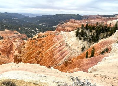
What To Do At Cedar Breaks National Monument
You can enjoy a wide variety of recreational activities at Cedar Breaks:
- Sightseeing from your vehicle
- Hiking
- Photography
- Camping
- Mountain biking
And in winter:
- Cross-country skiing
- Snowmobiling
- Skiing at Brian Head Resort
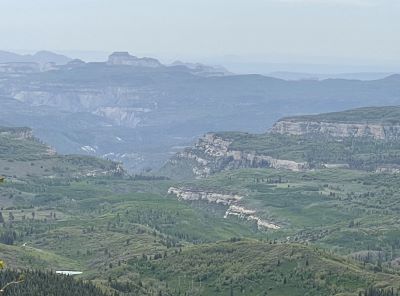
Grand Staircase Looking From Cedar Breaks
Where Is Cedar Breaks?
Cedar Breaks is 23 miles (37 km) east of Cedar City. Only 3 miles (4.8 km) south of Brian Head Resort. The latest fee structure I was able to find was as follows:
- For vehicles, it's $25 per vehicle. It is valid for seven days.
- Individuals entering on foot or bicycle pay $15 per person. It is also valid for seven days.
- A motorcycle pass costs $20 also good for seven days.
- An annual pass for Cedar Breaks specifically is $45.
- National Park passes (like the Interagency Annual or America the Beautiful) can also be used.
The fees seem to change almost every year. You can keep abreast of fee changes by going to their official website included at the end of this article.
The park is open from late May to the middle of October. There is a Visitor Center open from Labor Day until mid-October. It is a log cabin originally constructed by the Civilian Conservation Corps in 1937. As you might expect, the roads are closed during winter due to the deep snow.
In addition to the winter activities available at Brian Head, there is plenty to do even when the monument is closed. The Winter Warming Yurt at Cedar Breaks serves several functions.
It is a winter ranger station. It also serves as an education center. It welcomes cross-country skiers, snowshoers and snowmobilers in winter. You can stop in and sit by the fire. Even warm up with some hot cocoa.

Hiking Cedar Breaks
You can get a closer look at the unique geology of Cedar Breaks National Monument by taking one of the two hiking trails near the rim.
The Spectra Point/Ramparts Overlook Trail is four miles (6.4 km) round-trip. You get to enjoy astonishing perspectives of the amphitheater below.
The Alpine Pond Nature Trail is exactly what it sounds like. A double loop trail through the forests and meadows above the rim. It also provides some awesome views of the hoodoos.
Getting To Cedar Breaks
If you’re heading south on I-15 (from the direction of Salt Lake City, exit at Parowan. Head east on Highway 143 to Cedar Breaks. If you are travelling north on I-15 (from the direction of Las Vegas), take highway 14 east from Cedar City for 18 miles (29 km). Then take Highway 148 north for 4 miles (6.4 km) to Cedar Breaks.
If you need more information or need to contact them, this is the mailing address for Cedar Breaks:
Cedar Breaks National Monument: Administrative Office
2460 West Highway 56 Suite #6
Cedar City, UT 84720
Phone: (435) 986-7120
Website: https://www.nps.gov/cebr/index.htm
Have A Great Story About
Utah National Monuments?
Utah National Monuments?
Do you have a great story about this or any of Utah's National Monuments? Share it!


