Flaming Gorge-Uintas
National Scenic Byway
A High-Country Ribbon of Asphalt
Through
Awe-Inspiring Terrain
The Flaming Gorge–Uintas National Scenic Byway might be Utah’s most underrated drive. My wife and I recently drove it on our 1,800 mile road trip. This Scenic Byway was one of the highlights of the trip. It is definitely underrated in our book and we’ve been on a lot of scenic drives.
The Byway slips quietly out of Vernal heading straight north from the town’s Main Street on US-191 toward the south flank of the Uintas. It climbs up over the 8,400 foot summit and rolls through high meadows … the Ashley National Forest … studded with ancient spruce and teeming with wildlife.
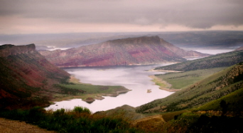
After the junction of US-191 and SR-44, it drops down (on either route) toward the red-walled chasm that John Wesley Powell called “a landscape of flame.” It takes you through the remarkable playground created by the damming of the Green River.
In just over sixty miles you pass millions of years of geologic history, two climate zones and one immense reservoir whose reflected sunsets could convince even the most jaded traveler to pull over with jaw agape.
One thing I’ve noticed when driving the Scenic Byways of Utah and even Colorado. We almost always seem to moving in the opposite direction of the Byway’s name. It seems to me that so many of the names should be reversed.
Flaming Gorge to Uintas, for example. Or Monument Valley to Bluff. Blanding to Hanksville. We always seem to be going in the opposite direction.
Getting Oriented
As mentioned above, long before ever reaching the dam, a western spur … State Route 44 … peels off at Greendale Junction and winds forty miles northwest to Manila. You can drive either route … the Vernal to Manila route or the Vernal to Dutch John route … in less than two hours without stopping but that would be like sprinting through an art gallery. Give it at least half a day.
That’s what we did but we agreed that a full day would’ve been better. As the Flaming Gorge-Uintas National Scenic Byway heads out of the Gorge towards the Utah-Wyoming line, it meanders through some amazing landscapes … with seemingly bottomless mostly treeless canyons … that are admittedly much different than what was just experienced.
Kiosks, Pullouts, and Mini-Trails
One of the Flaming Gorge–Uintas National Scenic Byway's charms is the group of roadside interpretive kiosks located along the route. Each pullout tells a short story. The signs are paired with short, family-friendly paths of usually less than half a mile.
They lead to viewpoints, fossil sites or flower-rimmed beaver ponds. You don’t even have to lace up boots or pack a lunch. Just step out, learn something, stretch the legs and roll on.
The Climb - Vernal to the Summit
Upon leaving Vernal at the south end, US-191 rises quickly through juniper foothills with the high Uintas in the distance. You’ll pass Steinaker State Park and the entrance to Red Fleet State Park just a few miles north of Vernal.
We stopped at both of those to do some research and take some photos. Ordinarily, these two parks are destinations in themselves so most people driving the Byway will fly right by unless it is your first time in the area.
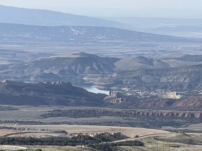
As you climb the south slope of the Uintas north of Vernal, the world suddenly opens up behind you if you stop to look back. To the south … where you came from … the valley spreads out like a green placemat.
To the north, the endless dark timber of the Ashley National Forest climbs toward the summit and then onward to the Gorge. The air here starts to carry the crisp, woodsy scent of spruce but, even in June, there is a hint of lingering snowmelt.
As the road zig-zags up the canyon, it snakes between cinnamon-colored hogbacks before emerging into dense Douglas-fir. At around 7,800 feet, you pass the Aspen Grove kiosk. If you feel like stopping, it is a good place to picnic among white-trunked quakies that glow gold in late September.
Be careful as you drive through the Ashley National Forest. There are deer everywhere. We were driving through on an early-June late morning. It soon became apparent that they don’t hesitate to run right out in front of you.
I know there are abundant elk and moose in the area but we didn’t see any. I can imagine a night-time drive might be challenging if you’re not careful.
Choose Your Own Adventure at
Greendale Junction
At mile marker 43, you reach Greendale Junction. This is the cross-roads of US-191 and SR-44. Turn left and Highway 44 heads towards Manila.
Continue north on Highway 191 and it drops towards Flaming Gorge Dam and then on to Dutch John. Either way, you eventually trade forest for cliff … and then water … although the forest continues right down to the reservoir and Dutch John. This is the route we took.
The Manila Spur
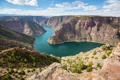
SR-44 rolls west and north across sage uplands scattered with pronghorn and wildflowers. Sheep Creek Overlook along this route is famous for its spectacular views of the crystal blue waters and marbled cliff walls.
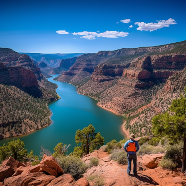
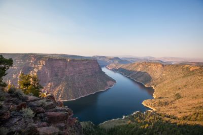
Just before Manila, you can turn off at Red Canyon Overlook. A two-minute walk puts you on the rim of a 1,400-foot precipice where peregrine falcons ride the thermals. The reservoir looks like a turquoise serpent trapped in stone. It is one of Utah’s finest viewpoints from the reading I’ve done and photos I’ve seen.
There is also a Visitor Center right by the Overlook. We took the other route so we missed out on these particular sights. We will be back to explore the SR-44 spur for sure.
The Dam Route
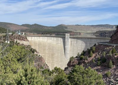
US-191 edges a limestone escarpment before revealing a shock of blue in the distance. Flaming Gorge Reservoir … 91 miles long … was carved by the Green River and corked by a towering dam completed in 1964.
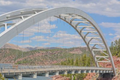
One of the highlights of the Dam Route is the Cart Creek Bridge. It is a steel arch suspension bridge which is located only ¾ miles from the dam. The dam itself is a little bit intimidating.
You drive right over top of it and the height of the dam reveals how deep the lake is at that point. The dam rises 502 feet (153 meters) above the bedrock or 455 feet (139 meters) higher than the original river channel. I’ve read some spine-tingling stories about divers sent into the water to inspect the dam.
It is so deep there that some of the divers tell stories of creatures (lake trout?) so big, they’re afraid to go back down. A diver too scared to dive. How big a fish would cause that?
As info, the Utah state record for a lake trout is 53 pounds, 15 ounces caught at Flaming Gorge on July 17, 2020.
What Makes The Flaming Gorge-Uintas
National Scenic Byway So Special?
Spend the day and you will encounter:
- abundant wildlife
- more dinosaur info than a normal person can handle
- unique geologic formations
- unbelievable scenery
- unequalled recreational opportunities
Few Scenic Byways anywhere serve up that mix in so short a distance.
A Playground on Water and Land
Flaming Gorge National Recreation Area sprawls around you for hundreds of square miles. Rent a kayak at Lucerne Valley Marina at Manila, troll for kokanee salmon near Anvil Draw boat launch area, or hike the half-mile Canyon Rim Trail (near the Manila spur Visitor Center) where evening light paints the cliffs a vivid apricot.
Anglers will know the Flaming Gorge area for its trophy lake trout (state records) and the tail-water fly fishing below the dam. It is one of the West’s most consistent brown and rainbow runs.
Off the water, little-visited canyons such as Cart Creek and Hideout Canyon hide good backcountry camps. And if you crave an even wilder detour, the unpaved, switch-backing Sheep Creek Geological Loop off SR-44 rolls past tilted strata, petroglyph panels and an oft-observed herd of Rocky Mountain bighorn sheep.
Seasons and Driving Tips
Spring arrives late at 8,000 feet and snowbanks linger into May. Summer days are warm but seldom scorching thanks to the elevation. Evenings will usually demand a fleece.
September is arguably perfect for people like me who don’t like extreme heat with crisp mornings and crimson oak/cottonwoods lining the Green. In winter, the Flaming Gorge-Uintas National Scenic Byway usually stays plowed but pullouts may be icy. The reservoir’s north end often freezes solid enough for ice fishing.
Keep an eye on your fuel gauge. After you leave Vernal your next reliable service is Dutch John (on the dam route) or Manila (on the spur). Cell service flickers in and out … as we discovered … so download maps before you go if you’ve never been to Flaming Gorge.
If you’re towing a trailer, US-191’s grade is steady but manageable. I’m told the SR-44 Loop is narrow so perhaps it is better left for passenger vehicles. Yours to research and it’s your call.
A Drive Worth Repeating
The Flaming Gorge–Uintas National Scenic Byway isn’t a one-and-done trip in my opinion. Drive it at sunrise when the cliffs ignite, in a July thunderstorm when virga curtains (where rain evaporates before it hits the ground) sweep the mesas, or under October stars so bright the reservoir gleams silver.
We were utterly mesmerized along the entire route as the landscape changed before our eyes.
- From the rolling landscapes of the south slope
- To the wild-flower meadows and forests of the high passes
- To the descent into the “Gorge” itself
- Then the brilliant sparkling waters of the vast lake below and alongside
- And beyond to the vast undulating canyons leading north from Flaming Gorge to the Wyoming border.
It was definitely one of the most scenic and exhilarating drives we’ve ever been on. We can’t wait to do it again. If you enjoy road trips, this is a must-add to your Utah bucket list.
Have A Great Story About Utah's
Scenic Byways?
Do you have a great story about this or any of Utah's scenic byways? Share it!


