Goosenecks State Park
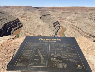
One of the Most Dramatic Views
in the American Southwest
We made another stop on our 1,800-mile road trip to southern Utah … at Goosenecks State Park … having no idea what we were going to experience when we got there. It is not a large park by acreage or amenities but it packs a visual punch that leaves many travelers stunned. That now includes my wife and me.
This isn’t just a stop on your way through the Four Corners region to get to someplace else. It is a geological marvel that offers a raw, panoramic look at one of the most dramatic entrenched river meanders in the world. All of this is located and visible in a remote stretch of southeastern Utah overlooking the San Juan River.
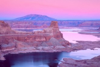
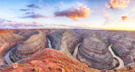
Perched 1,100 feet above the twisting river below, Goosenecks State Park provides an unbroken view of what geologists call an “entrenched meander.” To the rest of us? It is simply an unforgettable view.
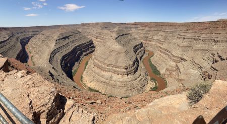
The View That Stole the Show
As we drove southwest from Blanding, Utah towards Mexican Hat on the way to Monument Valley, we knew we had to stop at Goosenecks regardless of how remote it may look on the map. It is, once again, our goal to visit every Utah State Park in person at least once.
Goosenecks State Park is found just 3 ½ miles west of Highway 163 between Bluff and Mexican Hat. The turn-off to the park is about 25 miles west of Bluff and 8 miles north of Mexican Hat.
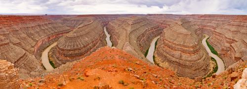
From the moment you step out of your vehicle and walk to the edge of the overlook, you will see the San Juan River make a 12-mile journey that only covers 5 miles “as the crow flies.” The looping, horseshoe-shaped canyons give the park its name. It looks much like the necks of geese twisting back and forth in a narrow canyon.
It is a spot that’s been described as both “otherworldly” and “eerily peaceful.” There is no hiking necessary to experience the view. It is right there waiting for you. A short stroll to the edge of the parking lot reveals a panoramic vista that changes dramatically depending on the time of day, season and even the weather.
Ancient Landscapes, Endless Horizons
The Goosenecks were carved by the San Juan River over the last 300 million years according to geologists. These deep meanders were first established on a flat plain. They say that as the Colorado Plateau slowly rose over millions of years, the river cut downward into the rock to maintain its course etching these winding paths deep into the Earth's crust.
The exposed rock layers on the canyon walls are part of the Honaker Trail Formation which dates back to the Pennsylvanian period of about 300 million years ago. This is one of the best examples of so-called incised meanders in North America and it is no surprise the site is often used in geology textbooks.
A Park for Stargazers and Solitude Seekers
Goosenecks is not your typical state park with visitor centers, interpretive trails or boat rentals. What it does offer is quiet, silence, solitude and stars.
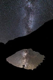
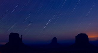
It is one of the best stargazing sites in Utah and has been designated an International Dark Sky Park. On a moonless night, the Milky Way feels close enough to touch.
There are, though, a handful of primitive campsites (first-come, first-served) that put you right on the edge of the canyon. There is no water, no hookups and not even much shelter. For those who know what they’re in for, it is unforgettable.
Park Information and What to Expect
- Elevation: 4,500 feet above sea level
- Total Acreage: Roughly 10 acres managed by Utah State Parks
- Camping: Primitive and limited. Vault toilets are available. No water. No hookups.
- Reservations: Not accepted. Sites are first-come, first-served.
- Fees: $5.00 day-use fee per car with up to 8 people. $2.00 day-use fee per vehicle for seniors (65+). $2.00 per person fee for bus tour groups. $10.00 per night per campsite
You can always check the state website for updated fee information.
Note: The wind here can be strong and relentless and the guardrails are easy to bypass at the overlook. Keep small children and pets close to you and battened down.
What Is Nearby?
Goosenecks is part of a wider region that invites exploration. Here are a few other attractions just a short drive away:
- Mexican Hat: A picturesque town just 8 miles south. Named after a rock formation that really does look like a sombrero.
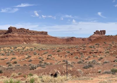
- Valley of the Gods: A stunning, less-trafficked alternative to Monument Valley.
- Monument Valley: Just 30 miles away and definitely worth driving the extra miles. We did and were thankful we did.
- Moki Dugway & Muley Point: For the adventurous driver, the unpaved Moki Dugway leads to incredible views of the San Juan River from above.
Little-Known Facts
- The meanders of the San Juan River are often cited as some of the most extreme examples in the world.
- Despite its remote location, Goosenecks was nearly designated a national park in the early 20th century but lost out due to its small size and limited access.
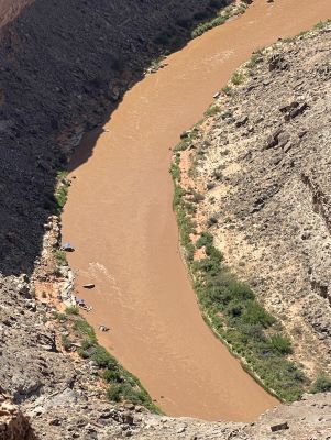
- The San Juan River eventually flows into Lake Powell though the stretch seen from the park is in its wild and undammed state. We actually saw a couple rafts far below that had banked on the shoreline. My son-in-law told me that he has rafted this stretch of the San Juan with the charming town of Mexican Hat as their home base.
- The San Juan River’s unique “goosenecks” cover 12 miles by kayak or boat but only 5 miles “as the crow flies.”
Tips for Visiting
- Best Time to Visit: Fall and spring offer the most comfortable weather. Summer can be scorching and winter nights can be bitterly cold.
- Bring Supplies: There is no potable water or food available at the park. Fill up in Bluff or Mexican Hat before arriving.
- Photography: Sunrise and sunset bring dramatic colors to the canyon. A wide-angle lens or, of course, a smartphone will help you capture the full view.
- Cell Service: Limited to non-existent. Download your maps ahead of time. We didn’t have any cell service at Goosenecks.
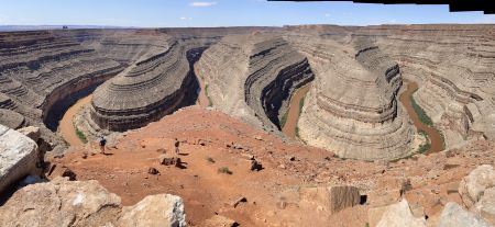
Standing at the overlook in Goosenecks State Park looking down on the San Juan River 1,100 feet below is breathtaking and almost a little unnerving for someone like me who doesn’t like heights.
There is a sizeable ledge below the sturdy railing that allows the adventurous to walk down a little lower and get a better view. That wasn’t for me. You can see a couple people below us in one of the photos above.
Directions to Goosenecks State Park
From Bluff, Utah:
- Drive west on US-163 for 25 miles.
- Turn right on UT-261 then left onto UT-316.
- Follow the road to the park entrance (about 3 ½ miles from US-163).
From Mexican Hat, Utah:
- Head north on US-163 for about 5 miles.
- Turn left onto UT-261.
- Then take UT-316 to the overlook (about 3 ½ miles from US-163).
Goosenecks State Park
c/o Edge of the Cedars State Park Museum (contact them)
San Juan County, Southeastern Utah
GPS: 37.1742° N, 109.9254° W
Phone: 435-678-2238
Website: https://stateparks.utah.gov/parks/goosenecks/


