Logan Canyon
National Scenic Byway
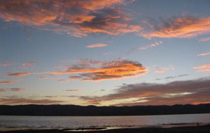
Gateway to the Canyon
Leave downtown Logan … home to Utah State University … and within five minutes you’re at the mouth of Logan Canyon. This section of US-89 is better known as the Logan Canyon National Scenic Byway.
The road narrows, the temperature drops a few degrees and the Logan River settles in as your companion on almost the entire route. It is forty-seven miles of high-country drama linking Cache Valley to the Bear Lake Valley.
A Personal Favorite
If you are a frequent visitor to my site, you know I love road trips. Seems like I say this a lot but, yes, this is one of my favorites. For several reasons, some of them nostalgic.
My wife and I have been driving this canyon for decades. It involved yearly trips up to my wife’s family cabin tucked in the aspens less than a stone’s throw from the highway.
After we had skipped the jaunt for several years due to a variety of reasons, recent trips the last two years brought back a lot of fond memories.
For those new to the area, a quick stop at the Forest Service Visitor Center … at the mouth of the canyon … nets the latest trail conditions, fishing reports and maybe a tip on wildlife sightings people have reported up the canyon. There has been recent construction along this road over the summer of 2025 so check for delays.
Land Shaped by Ice and People
Shoshone bands once hunted these ridges and fished the Logan River. Trappers and mountain men then followed leaving rough cabins and names like “Beaver Mountain” and “Tony Grove.”
The Bear Lake Rendezvous was an annual gathering of fur trappers, also known as Mountain Men, held near Bear Lake during the fur trade era. Lasting several days, it served as a crucial trading fair where trappers could exchange their furs for supplies like weapons, tools, and clothing.
Eons before that, glaciers gouged out high valleys evolving even today as spring melt sculpts the limestone walls that flash ivory in the late-day sun.
Highlights of The
Logan
Canyon National Scenic Byway
First Ten Miles: River & Reservoirs
At the lower end of Logan Canyon National Scenic Byway, watch for the First, Second, and Third Dams. These are little impoundments popular with stand-up paddlers and picnic crowds.
Early morning fog often hangs in the cottonwoods. Fly anglers work the riffles for wild browns that can, at times, still top twenty inches.
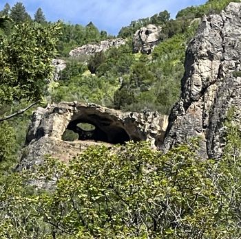
About five minutes up the canyon, a tiny parking strip announces one of the canyon’s signature hikes. The three-mile climb gains 1,100 feet and rewards with appropriately named limestone arches punched through by eons of frost and wind. This is a great hike in spring, summer or fall.
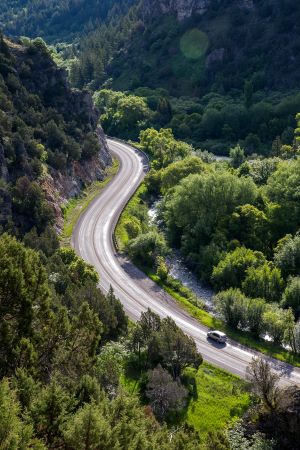
Tony Grove Turnoff
Two-thirds of the way up the canyon, a spur road zig-zags up the mountain for seven miles to Tony Grove Lake. It is a shimmering alpine slice of heaven ringed by immense cliffs. Wildflowers peak mid-July rivaling anything in Glacier or Yellowstone.
The easy lake hiking loop suits children. Hardcore hikers launch from here to tackle Naomi Peak, the highest point in the Bear River Range.
My wife and I have done that one and it’ll tax even fit people. It took us about four hours total back when we were a little younger.
Beaver Mountain and the Summit
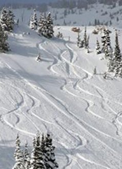
Further up the canyon, another side road T’s off the Byway headed towards Beaver Mountain Ski Resort at about 7,800 feet. Billed as Utah’s oldest family-owned hill, its north-facing slopes pile up airy powder in winter. In summer, the lifts lie idle while mountain bikers ply the adjacent Forest Service land.
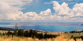
Bear Lake is the “Caribbean of the Rockies”
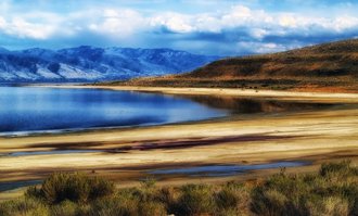
At the top end of the Logan Canyon National Scenic Byway … at 5,924 feet … Bear Lake straddles the Utah-Idaho state line. Bear Lake is an almost shocking turquoise-blue born of suspended limestone compounds that bend the light just so.
That color is the reason some people call it the "Caribbean of the Rockies." It certainly isn't for the climate. And I never felt comfortable calling it that knowing what the winters are like up here.
It is a huge lake covering 71,680 acres or more than 112 square miles.
Sandy Rendezvous Beach lures boaters and swimmers during the summer. Yet even on hot July days, the local temperatures hover between 70 ° - 80º F.
Local stands sell "world famous" raspberry shakes. It is a nod to the orchards that still fringe the valley although a lot of the agricultural land has been sold off and developed.
This summer’s stop … and a vacation a couple years ago at a Bear Lake cabin … made us realize just how much the area has grown. It is not a secret anymore even though some people seem to think that cool places will remain “unknown” once they arrive. No, they can’t shut the door behind them.

Four Seasons of Possibility
- Spring: Snowmelt swells the river. Gravel chutes glow with balsamroot (a native Utah wildflower with sunflower-yellow petals). Road cyclists test their legs on the wide variety of trails of every grade.
- Summer: Kayaks on the lower dams and even the Logan (for thrill-seekers). Trout rising at dusk. Cool canyon air as much as twenty degrees below the valley floor.
- Autumn: Maples ignite scarlet. Quakies flare gold. Elk bugles echo at dawn near Franklin Basin.
- Winter: Beaver Mountain spins lifts. Snowmobiles hum along Sinks Road. Ice climbers swing tools into frozen seeps above Third Dam.
Recreation Without Massive Crowds
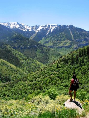
Despite its beauty, Logan Canyon still seldom feels overrun especially the further from Logan you go. Pullouts remain available on summer Saturdays and you can still hear water over vehicle noise in some places.
Campgrounds like Guinavah-Malibu and Sunrise fill on weekends. At least they used to. Some of the lower campgrounds appeared to be shut down due to flooding this past June. Check the state websites to check which ones are open and to reserve a spot.
Dispersed camping … legal 150 feet off most side roads … offers true solitude beneath a blanket of stars if you like to rough it. We used to do a lot of this more primitive stuff … “to test ourselves … when we were younger but prefer a more comfortable setting now.
Safety & Practical Notes
The canyon’s curves are tight with no shoulders for much of the route. Keep your eyes peeled for motorcyclists and cyclist bombing downhill. And deer crossing the highway especially at dusk.
In fact, this past June, we saw several dead deer and even a dead elk along the roadside. Any idea what hitting an elk will do to your car or motorcycle (and you) let alone the elk?
In winter, black ice hides in shaded bends. The plows are out early, but AWD … and patience … pays off. We remember there being no fuel available between Logan and Garden City but now, 27 miles east of Logan, is the newly renovated and expanded Beaver Creek Lodge.
Restrooms, food, fuel, rentals and lodging are available at the Lodge. Cell signal fades for a lot of the canyon but it is getting better.
They were laying some kind of cable in the canyon this past summer and were taking it up towards Beaver Mountain. It is amazing where you find cell towers now.
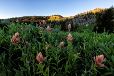
Photo: Travel Utah
A
Drive Worth Repeating
If you happen to be in the Logan area, the Logan Canyon National Scenic Byway is one road trip I would highly recommend. It normally takes us about an hour to go from the bottom to Bear Lake.
Add in another hour or two for a burger and raspberry shake … or some sight-seeing … and then the hour back to Logan and you can do this in a morning or afternoon if you’re already in the area. Plan ahead, take your time and enjoy it.
As info, if you take the Wyoming route from Bear Lake east and then down to Evanston to return to Salt Lake City, it takes almost the same amount of time.
We’ve done both. Not as scenic that way but a different route if you drove up from Salt Lake City.
To take that route back, take Highway 30 from Laketown to Sage Creek Junction. Then head south on Highway 16 to Evanston.
Don’t speed through the small towns. They’re waiting for you. Take I-15 back to Salt Lake City.
Have A Great Story About Utah's
Scenic Byways?
Do you have a great story about this or any of Utah's scenic byways? Share it!


