That You Were Never The Same?
Patchwork Parkway
National Scenic Byway
Patchwork Quilts, Cliffs and Cool
Mountain Air
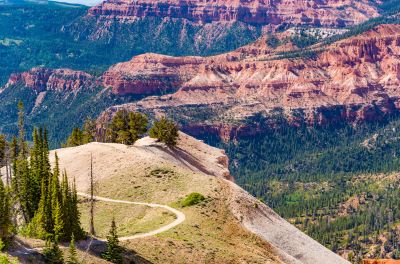
The beauty of the Patchwork Parkway National Scenic Byway … Utah SR-143 … is that it is one of those drives that sneaks up on you. You roll out of Parowan … just off I-15 in southern Utah … past a few tidy front yards. Within minutes, though, you’re winding into Parowan Canyon beneath red rock ramparts locals call the Vermilion Cliffs.
The road climbs quickly trading desert heat for spruce shade and clear, high-country air. Fifty-five miles later you drive into Panguitch. It’s a historic brick-and-barn town with fishing stories on every porch.
In between? Brian Head’s ski slopes, Cedar Breaks’ painted amphitheater, and the deep, cold water of Panguitch Lake. Of course, like all of these scenic drives, they are just as good going in either direction. Start in Panguitch and end up in Parowan if you want.
Why “Patchwork”?
The byway’s name doesn’t come from a marketing campaign. It’s local history. In the winter of 1864, Panguitch settlers, desperate for flour, set out for Parowan.
They found the snow so deep their boots broke through with every step. They laid down patchwork quilts and walked across them moving each quilt forward, one after another, until they reached help.
The route they stitched together across the Markagunt Plateau is celebrated every June at Panguitch’s Quilt Walk Festival. That story gives the mountain road its name.
Drive SR-143 and you’ll understand what it might be like in winter. In most years, snow stacks deep up here and lasts well into spring. Storms roll in fast.
Up Parowan Canyon
From Parowan (elevation 6,000’), SR-143 tilts uphill and doesn’t look back for a while. The canyon narrows, the river chatters beside you, and the rock walls shift from cinnamon to rust to cream.
Pullouts appear just often enough so you can step out and hear the water. In summer you’ll smell sun-warmed sage at the lower bends.
Wet stone and spruce resin waft through the air as the grade steepens. This is the kind of climb that makes you grateful for a good set of brakes on the way down.
Brian Head
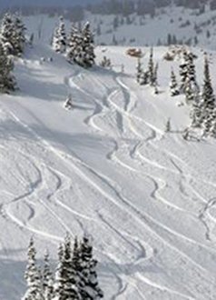
At roughly 9,800 feet, you reach Brian Head. It is Utah’s highest incorporated town. Winter belongs to skis and boards. Summer turns the lifts into mountain-bike shuttles and trailhead access.
On a clear day, a short side drive to Brian Head Peak (gravel when open) reveals a horizon you’ll swear stretches to Nevada. Even if you don’t leave the pavement, the air alone feels different up here. It is fresh, bright, thin and a little piney.
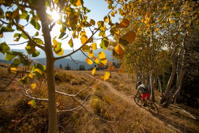
Photo - Travel Utah
Cedar Breaks National Monument
Skirting the south edge of Cedar Breaks National Monument, SR-143 threads beautiful meadows. Elk graze at dusk and mule deer don’t hesitate to step out in front of you. Some of the bristlecone pine up here have watched the centuries pass.
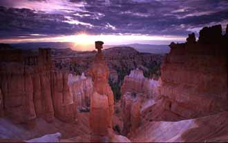
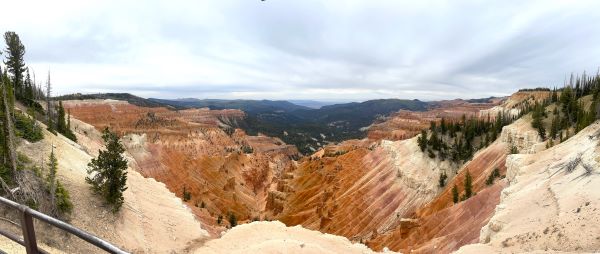
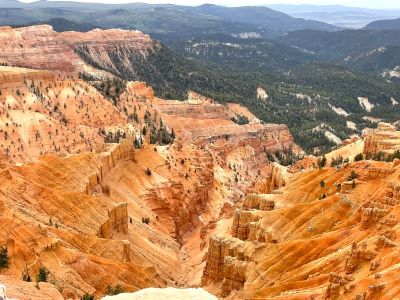
Cedar Breaks itself is spread out just a few minutes’ detour away (via SR-148 when plowed) with overlooks like Point Supreme that live up to the name. People drive through this area and are amazed when the light breaks through a cloudbank setting the hoodoos ablaze with color.
Some people may see a similarity between Cedar Breaks National Monument and Bryce Canyon National Park. At more than 10,000 feet above sea level and with miles of painted cliffs, sure there are similarities.
But as I said in my article about Bryce, I think the colors of Cedar Breaks may be more intense than those visible in Ebenezer Bryce’s bowl. It is one of the most colorful of all Utah parks and monuments.
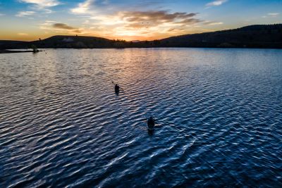
Photo - Travel Utah
Panguitch
Lake and The Long Exhale
About twenty miles beyond the Brian Head turn, the road tips toward Panguitch Lake. It is a deep, cold reservoir tucked into the trees. The name “Panguitch” comes from the Paiute word for “big fish,” and the lake lives up to that name.
Cabins, campgrounds, and a couple of classic mom-and-pop stores line the shore. One summer, after a family reunion in scorching Cedar City below, we stopped to camp for a single night at a campground near the lake.
After one night, we were so enthralled with the area that we stayed for three days. I remember sitting in a camp chair reading and relaxing while the breeze stirred up the surrounding forest. We didn’t want to leave but we had work and other obligations back then.
When fall arrives in this area, the quakies ring the surrounding hills with a shimmering gold halo. It’s as photogenic as anything in the state. You don’t need to hike miles to see it. Just step out of the car and let the leaves do their thing.
The Panguitch Lake Dam, has recently undergone repairs due to a crack in the dam's concrete structure. Said to be caused by ice pressure, the crack actually led to a partial failure of the dam's upper section.
Emergency repairs included stabilizing the dam with rockfill. Water had to be released drawing the lake levels way down. It looks like this was successful in preventing a catastrophic failure.
The dam is a vital water source for the surrounding area. The repairs were crucial for the community and also for the recreational patrons of the lake.
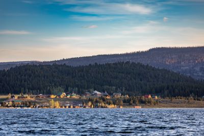
Photo - Travel Utah
Down to Panguitch
From the lake, SR-143 glides off the plateau toward Panguitch (elevation 6,600’). A quaint little town of red-brick storefronts and tidy grid streets, it sits where US-89 meets SR-143.
Panguitch makes an easy base for Bryce Canyon National Park day trips only 23 miles away. It has some historic homes, a couple of solid diners, and summer events that feel straight out of a Norman Rockwell painting.
If you time it right, the Panguitch Valley Balloon Rally in late June lofts dozens of hot-air balloons against a blue mountain morning. If you’ve ever watched one of these balloon festivals, you already know they’re hard to beat.
The Drive in One Sweep
On paper, the Patchwork Parkway National Scenic Byway is 55 miles long and takes about an hour and a half without stops. In real life, it’s one of those routes where time doesn’t matter.
You’ll find yourself pausing to take roadside shots of a meadow full of lupine or an elk herd threading a treeline. Storms sweep across Cedar Breaks like a stage curtain.
Elevations swing from about 6,000 feet in Parowan to well over 10,000 feet near the rim. Temperatures drop fast as you climb so keep an extra layer handy even in July.
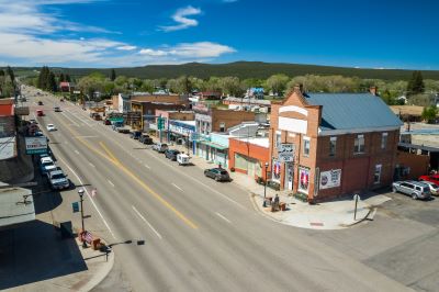
Photo - Travel Utah
Quick Stops Along The
Patchwork Parkway National Scenic Byway
I try not to turn scenic byways into checklists but these are hard to skip:
- Parowan Canyon pullouts early in the climb for canyon-laced photos and a stretch by the river.
- Brian Head for lunch with crisp mountain air and, if you’re up for it, a quick viewpoint detour.
- Cedar Breaks rim (when SR-148 is open) for an amphitheater view that feels painted rather than carved.
- Panguitch Lake to watch glass-still water at sunrise or tempt a trout before dinner.
Seasons and Conditions
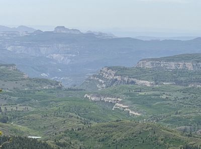
SR-143 is gorgeous year-round but it’s a legitimate high-mountain road. Summer brings perfect air and wildflowers in the meadows. Fall turns the hills into a patchwork quilt that matches the byway’s name.
Winter can be nasty. Parts of the route are often impassable after big storms. Chain controls or closures are not uncommon at the highest points. Cedar Breaks’ connecting road (SR-148) typically closes for winter.
The Patchwork Parkway National Scenic Byway may remain open but can be snow-packed and slick. Spring can linger well into May up here. Expect snowbanks in the shade long after the townspeople below are mowing lawns.
Check UDOT conditions during questionable months. Fuel up before you climb and make sure your brakes and cooling system are in good shape.
Trailers can handle it but long grades deserve respect. Cell service fades at times so if you don’t know where you’re going, download maps ahead of time.

Getting There and Why You Want To
From I-15, take Exit 75 into Parowan to start the drive east. Let the canyon do its work. If you’re coming from Bryce or the US-89 corridor, roll west from Panguitch to climb back toward the lake and the rim.
Driving in either direction delivers the same rewards. Cooler air, dark timber, big color and a sense that you’re somewhere special without being too far from a hot shower and a good burger.
I’ve driven a lot of Utah but the Patchwork Parkway National Scenic Byway is one of my favorite roads. Maybe it’s the way the road stacks the state’s greatest hits … red rock, alpine meadows, clear blue water, small towns … into a single, easy day.
Have A Great Story About Utah's
Scenic Byways?
Do you have a great story about this or any of Utah's scenic byways? Share it!


