Trail of The Ancients
National Scenic Byway
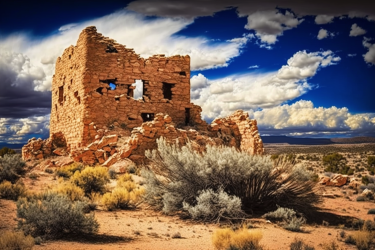
Ancient Civilizations, Quiet Roads
& Modern Culture Meet in Utah’s Southeast
The Trail of the Ancients National Scenic Byway isn’t a single ribbon of highway so much as a network of routes through time. And through this amazing area.
In the Four Corners Region of Utah, it links small towns and lonely mesas with cliff dwellings, rock art, museum collections and sandstone country that will make you pull over more than once.
It’s not a “drive fast and check it off” kind of byway. It’s a slow-breath loop through the homelands of the Diné (Navajo), Ute, and the ancient peoples we call the Ancestral Puebloans. Along the way, modern road signs point you toward places that are anything but modern.
What The Byway Is And
Where Do You Approach It?
Trail of the Ancients National Scenic Byway forms a flexible loop through San Juan County. Most travelers start in Blanding or Bluff. Then they string together segments of US-191, UT-95, UT-261, UT-163, and UT-262 with short spurs to key sites.
Think of it as a make-your-own-adventure. Visit museums and go on short walks if you’re on a timetable. Drive dirt roads, stop at overlooks, and explore canyon hikes if you’ve got a couple days. It can definitely include lots of driving if you enjoy road trips.
This byway actually includes part of the Monument Valley to Bluff Scenic Byway. Trail of the Ancients is a National Scenic Byway. These are federally designated so you may see some overlap among some of Utah’s Scenic Byways.
One way to drive this byway is to begin in Blanding, swing west to Natural Bridges National Monument, drop south over Cedar Mesa and the Moki Dugway, thread Valley of the Gods, past Goosenecks State Park and Mexican Hat, then turn east to Monument Valley.
Then you can angle back toward Hovenweep National Monument which skirts the Utah–Colorado state line. This route covers a lot miles and, to do it justice, you won’t see everything in one day.
That’s part of the charm of the Trail of the Ancients National Scenic Byway. Of course, you can do it in whatever order you want or just drive parts of it. There’s no best part.
Edges, Folds, and River Bends
Before there was archaeology, there was the land itself. Trail of the Ancients National Scenic Byway rides the long spine of Comb Ridge, a dramatic sandstone monocline that looks like a petrified wave. It crosses the Cedar Mesa highlands where piñon and juniper cling to shallow soils.
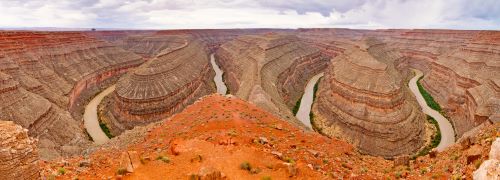
It peers down over the San Juan River, famous for its serpentine meanders at Goosenecks State Park. There it has sliced a 1,000-foot canyon through layer after layer of sediment. Further south, the silhouettes of Monument Valley stand like stone ships at anchor.
None of the modern routes are accidental. Every road follows a natural path the earliest travelers knew about and followed. We just get to explore the trails they took in much more comfort.
Core Highlights To Plan Your Loop
- Edge of the Cedars State Park Museum (Blanding): Start with the story. It is a working museum with world-class pottery, tools, and a restored kiva you can climb into. It took us about 45 minutes to walk through before starting a long day of travel.
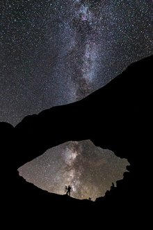
- Natural Bridges National Monument: Three grand stone bridges and a dark-sky night if you linger until after sunset.
- Moki Dugway & Muley Point: A carved-into-the-cliff descent and an overlook that feels like the edge of the world. Keep track of those clouds in the distance.
- Valley of the Gods: A quiet, graded dirt loop past free-standing buttes. It stands as Monument Valley’s cousin but without the crowds.
- Goosenecks State Park: The San Juan River doing six miles of work in a mile and a half as the crow flies. This may not be as well-known as some of the sites listed but this overlook is absolutely stunning. Don’t miss it.
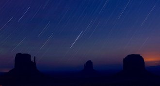
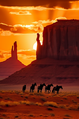
- Monument Valley: The icons you’ve seen on a thousand postcards. It is better in person. Drive off the main road on the short detour into the Navajo Tribal Park and hire a guide to reach the backcountry.
- Hovenweep National Monument: Delicate stone towers perched on canyon rims. The Utah group of structures (Tower Group) has nine structures and is another can’t miss site. Silent, intricate, memorable. It requires about a 2-mile hike to see all of them. It took us about 1 ½ hours to walk through the Tower Group.
- Sand Island Petroglyphs (near Bluff): A vast panel right off the road with figures and stories you could study for an hour.
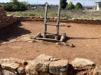
Layers of Time You Feel Like Touching –
But Don’t Do It
Every stop on this byway is a doorway into a longer story. At Edge of the Cedars, labels and timelines anchor what you’re about to see out in the canyons.
On Cedar Mesa, short walks off UT-95 lead to trailheads for ancient kivas tucked into alcoves and masonry that’s stood for 800-1,000 years.
The stone work looks sturdy. It actually is as some of it has stood for centuries. But it’s also fragile. Don’t climb, don’t lean, don’t sit on walls. Resist the urge to pick up pottery sherds (correct spelling as I’ve learned).
Photograph them, admire them, but leave them where they lay. It is illegal in Utah to remove any archeological resource from public lands. On private lands, you need the owner’s permission to do so.
This is not legal advice. The museums, such as Edge of the Cedars, spend a considerable amount of time trying to drill into people’s heads stories of archeological theft throughout the southwestern US. It’s a long and sordid history.
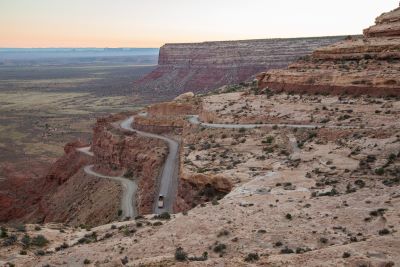
The Moki Dugway: The Zipper
Between Mesa and Desert
If you’ve never driven it, the Moki Dugway might be one section to add to your list. It is three miles of well-graded dirt switchbacks dropping 1,200 feet off Cedar Mesa on UT-261.
It is wide enough for cautious two-way traffic and passenger cars in dry weather. Even so, the grade is serious and the edges can be unnerving. Storms can roll in and curtain the desert below.
This can also make the dirt road a little treacherous. If you prefer pavement, you can swing a longer arc on US-191 and 163. You won’t regret either choice.
Two Places to Linger
Natural Bridges National Monument rewards you for the drive west of Blanding along SR-95. Each overlook gives you a different angle and the short hikes let you feel the scale that the viewpoints can’t convey.
Further south, Goosenecks State Park is a must see. Take SR-261 off US-163 for a few miles and follow the signs. It is amazing if you can make sunrise or sunset. In low light, the canyon walls pick up peach and russet tones while the river coils below like hammered copper.
Monument Valley
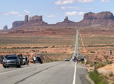
When the buttes and spires of Monument Valley first pull into view on US-163, you’ll understand why movie-makers kept coming back through the years. The 17-mile self-drive loop hits the highlights. Navajo-guided tours go deeper.
This is Navajo land managed by Navajo Nation Parks & Recreation. Follow posted rules and ask before photographing people.
Buy directly from the artisans at the roadside stalls when you can. A piece of hand-stamped silver or a basket carries the place home better than any trinket.
Seasons, Weather, and Patience
Spring and fall are gentle. Cool mornings, warm afternoons, and long, clean light. We toured this area in early June and the temperatures were ideal.
Summer brings heat and monsoon bursts that can make dirt roads sloppy. In fact, on our visit, some of the roads into Monument Valley were closed due to flooding from early June thunderstorms the night before.
Winter is crisp and quiet. Snow dusts the rims and you might have a whole overlook to yourself. Services are widely spaced. Top off your tank in Blanding, Bluff, Mexican Hat, or Monument Valley.
Carry more water than you think you need. Cell service fades in and out once you leave the towns but it was actually better than we expected. It seems like there are now cell towers in the unlikeliest of places.
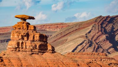
How To Get To
Trail of the Ancients National Scenic Byway
From Moab, drive US-191 south (about 75 miles) to Blanding or Bluff and pick up the loop. From Cortez, Colorado, follow US-160 to CO-41/UT-262 toward Aneth and Montezuma Creek, then bend west to Bluff.
From Page or Kayenta, AZ use US-160/US-163 to reach Monument Valley and climb north into the loop.
From Salt Lake City, it’s a six-hour push to Blanding via I-15/US-6/US-191. A haul but worth it if you’ve got a long weekend and a curious streak.
A Byway Best Taken Slowly
We’ve driven slices of this route in a day and full loops over a couple days. The sweet spot is somewhere in between.
Give yourself room to stop when something catches your eye or a canyon swallows the afternoon light just right.
The Trail of the Ancients National Scenic Byway doesn’t shout. It invites. Walk a little farther than you planned. Read the signs.
Let the wind and the silence reset your attitude. You’ll leave this area already planning to come back. Happened to us.
Have A Great Story About Utah's
Scenic Byways?
Do you have a great story about this or any of Utah's scenic byways? Share it!


