Cecret Lake
It’s
Not a Secret
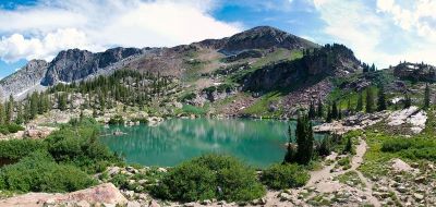
Cecret Lake is a small, beautiful alpine lake tucked above Albion Basin near the top of Little Cottonwood Canyon. It is also above the Alta Ski Area and below the rocky ramparts of Devil’s Castle.
USGS maps have long labeled it “Secret” but you’ll see it more often spelled with a “C”. That’s the name posted on Alta’s summer trail map and signage.
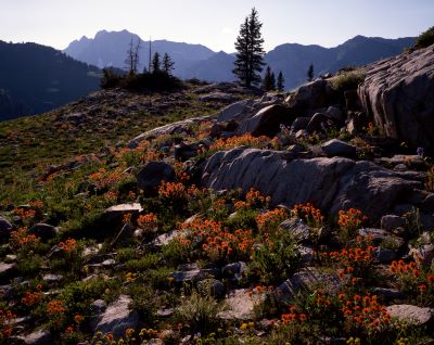
The walk is family-friendly. The scenery is classic Wasatch. And in late July and early August, the wildflowers can be outrageous.
Trail
Options and Difficulty
From the Cecret Lake Trailhead (reached via Alta’s Summer Road), it’s about 1.7 - 2.0 miles round trip with 420 - 500 feet of altitude gain. It’s an easy-to-moderate hike for most though the final switchbacks are a bit steeper and the altitude may challenge sea-level visitors.
Expect 60 - 90 minutes of hiking time plus photo stops. If you’d like a longer outing, you can start lower and hike via Upper Albion Meadows which makes the route 4.5 miles round trip with 1,200 feet of gain.
Parking,
Fees, and
How Access Works Now
This is the part that has changed the most in recent years since our last visit. In summer, Alta’s Summer Road climbs a well-graded dirt road into Albion Basin and provides vehicle access to trailheads for Cecret Lake and Catherine’s Pass.
A per-vehicle amenity fee is charged at the booth. Alta lists the fee as $12. Parking at the upper trailheads is limited and often fills early on weekends.
If you don’t want to drive the Summer Road or find the upper lots full, free parking is available at the Albion and Wildcat base areas. Parking is available in the town of Alta/Grizzly lot. You can walk the longer Upper Albion Meadows trail to reach Cecret Lake.
A few practical notes:
- Arrive early (well before mid-morning on fair-weather weekends) to improve your odds of finding a legal spot at the upper trailheads. Road-shoulder parking isn’t allowed in the basin. There are only a few dozen spaces near the trailhead.
- Seasonal timing: The Summer Road typically opens late June to early July depending on snow. Check current status before you go. Some lower trail segments may see temporary closures or reroutes for restoration.
- October may be too late.
A Video Offers Some Perspective
Important
Watershed Rules
Little Cottonwood Canyon is part of Salt Lake City’s protected watershed. No dogs (not even in your vehicle) and no swimming or wading in any lakes or streams.
This includes hiking to and from Cecret Lake. These rules are strictly enforced to help keep the valley’s drinking water clean. Stay on signed trails to protect fragile tundra and wildflowers.
What
It’s Like on the Trail
From the Cecret Lake trailhead, the path climbs gently through meadows and low pines. It crosses rocky sections and a few wooden bridges.
As usual throughout Utah, ever-present interpretive signs highlight geology and flora. The final push switchbacks to a natural dam and then … boom … the little lake appears.
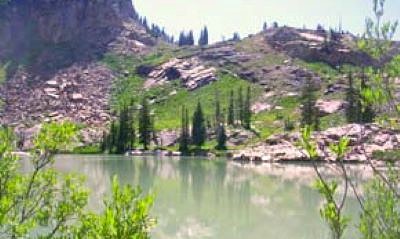
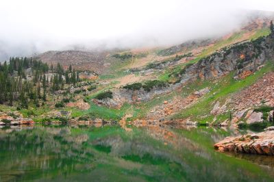
The north face of Devil’s Castle … a jagged limestone wall … may steal the show on clear days. On calm mornings the lake reflections are perfect.
By midday the breeze usually ruffles the surface. On our last visit, we spent some time just sitting and staring at the lake.
It was long enough ago (14 years?) that there were no other people around. Don’t expect that now.
There seem to be people everywhere we go in this state now.
Wildflowers,
Wildlife, and Seasons
Albion Basin is one of Utah’s premier wildflower venues. Peak bloom lands late July into early August. The timing can shift with the depth of the previous winter’s snowpack and unpredictable spring weather.
It seems that everything in the Utah outdoors arrives a later than it used to. Spring, summer, fall (and the changing leaves), and then winter all have been arriving later in the year.
This isn’t just anecdotal. We’ve lived this for decades and the trend is real.
The Wasatch Wildflower Festival rotates among the four Cottonwood Canyon resorts each July. This includes an Alta day.
If you like to be guided … and like being social … it may be a fun way to learn the blooms with volunteer naturalists. In September, aspen and groundcover start to turn.
By October, you’re flirting with early cold snaps and the first snows. Looking up now from my office window in Mid- October, there’s already snow on the mountain-tops.
Weather
and Altitude
Cecret Lake is in high country. It is near 10,000 feet at the lake. The weather changes fast at this altitude.
Thunderstorms build most afternoons in midsummer. Get an early start and be ready to retreat from ridgelines if you hear thunder.
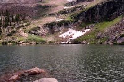
Pack a light shell, a warm layer, and more water than you think you’ll need. Don’t be surprised if you see snow along the trail in July.
It’s been a long time since we’ve hiked this trail but, yes, there was snow along the trail in mid-July.
Add-On Adventures
If you’re feeling strong and conditions are dry, you can continue past the lake toward Sugarloaf Peak for bigger views. It is Class 2 hiking with loose rock and is best left to experienced hikers.
At 11,051 feet, Sugarloaf is the 13th highest peak in Utah. Hiking further can add two or more hours to your hike. I’m not including those hike details here as I’ve never tried it.
Many families linger at Cecret Lake’s shore and explore the signed geology panel. Either way, give the delicate shoreline plants a wide berth.
Alta’s summer map marks Cecret Lake as an intermediate hike. Bikes or e-cycles aren’t allowed on this singletrack.
Driving
Directions
From Salt Lake City, take I-215 to 6200 South. Then follow SR-210 up Little Cottonwood Canyon to Alta.
For the upper trailhead, continue past Alta onto the Summer Road (graded dirt) and pay the amenity fee at the booth. Proceed to parking near Cecret Lake or the Albion Basin Campground.
For the base-to-basin option, park at the Albion or Wildcat lots … for free … and hike the Upper Albion Meadows trail to access the Cecret Lake trail. These roads and parking lots have proper signage for identification purposes.
Passenger cars are fine on the Summer Road when it’s open. The final mile is unpaved but routinely graded. You don’t want to be up here in extreme weather.
The
Cecret Lake Hike At a Glance
- Distance/Gain: 1.7–2.0 miles round-trip. 420–500 feet from the upper trailhead. It’s a 4.5 mile round-trip via Upper Albion Meadows.
- Season: Late June/early July - September (snow dependent).
- Parking: Limited at upper trailheads. There is a fee to access Summer Road. Free at base lots with longer hike.
- Regulations: No dogs. No swimming or wading. Stay on the trail.
- Crowds: This is a very popular area especially on wildflower weekends. Arrive early or go on a weekday.
Final
Thoughts
Cecret Lake is one of the easiest ways to feel like you’ve stepped into a high-alpine postcard. Keep expectations flexible.
Parking and weather rule the day. I call it “being imperturbable”. Roll with the flow. Don’t let it bother you.
Don’t let unforeseen obstacles ruin your day. Always be prepared to make alternative plans and you won’t be disappointed.
The more people that move to Utah … and especially the Salt Lake City area … the more inundated nearby areas become. They’re close by and they’re spectacular.
Honor the watershed rules. Aim for the earliest morning start. Given that, you’ll be more successful with regard to parking and avoiding the crowds. If the upper lots are full, don’t force it.
Park at the base. Make it a longer walk through Upper Albion Meadows. Enjoy the extra wildflowers along the way.
Imperturbable. The word of the day. It goes along with the feeling you’ll get on reaching Cecret Lake.


