Grand Staircase-Escalante
National Monument
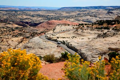
A Controversial National Monument From The Start
The Grand Staircase-Escalante National Monument was established in September 1996 by President Clinton. It was a controversial announcement at the time. And it still is.
On December 4, 2017, President Trump pronounced ... in an equally controversial move ... that the monument's size would be reduced by almost half. When Biden stepped up to take his swing, his signature was on an order that restored the Monument to its original size.
He did it using a Presidential Proclamation under the authority of the Antiquities Act of 1906. The Antiquities Act gives the President the authority to designate or modify national monuments to protect areas of historic, scientific or cultural significance.
There are still additional lawsuits … especially by the state of Utah … moving through the courts now.
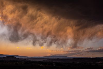
A Vast, Desolate and Breathtaking Landscape
The Grand Staircase-Escalante National Monument is a vast and desolate area. How desolate is it? Well it was the last place in the continental United States to be mapped!
Even with Highway 12 running right through the middle of it, it remains a mysterious and relatively unexplored frontier due to its vastness. Its bone-dry conditions only add to the harshness of this landscape.
The monument … depending on which party is in power … covers 1.7 million acres of public lands. Many people in the state of Utah were very upset when President Clinton designated these lands as a national monument without any discussion or warning in September 1996. This was mainly due to how much land was included in the designation.
Making these lands available to mining interests could have brought huge monetary rewards to many of these people. But even though these lands were located in Utah, they were “owned” by the American people.
It is an ongoing battle in this state between those who want to continue to rely on a resource-based economy and those looking towards the tourism/recreation model. The latter has absolutely exploded Utah’s economy in the last 3 – 4 decades.
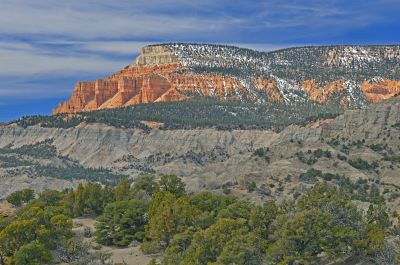
Why The Name Grand Staircase?
The land ascends up into wide, sloped terraces just like a staircase. Because of the size of the monument, obviously the landscape does change throughout its boundaries.
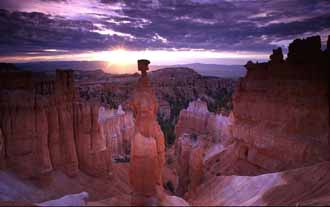
At the southern end, instead of a staircase, prodigious intensely hued cliffs rise up. Pink, white, gray, vermilion. Millions of years of geologic history are visible in dramatic escarpments.
The Grand Staircase-Escalante National Monument is an extraordinary “gold mine” of information for scientists because of the area it covers and the unique mix of resources found within its boundaries. Once again, that’s also a reason for some of the backlash which occurred after the monument was set aside.
But most of those geologists,
archeologists, paleontologists, biologists and, of course, the many visitors to
the monument are happy these lands are now protected from development.
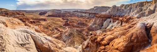
Three Sections Make Up Grand Staircase/Escalante
The Grand Staircase is divided into three distinct sections:
- The Grand Staircase
- The Kaiparowits Plateau
- The Canyons of the Escalante
These three sections are very dissimilar in terms of topography. But they are similar in certain respects. They cover a large area and the terrain is extremely difficult.
Despite being located in the continental United States, they are also unusually remote. These factors combine to make this a dangerous and inhospitable land if you’re not prepared for it. Even so, if it’s solitude and adventure you seek, you’ll find it here.
Just do your research and realize how many headlines we see each year telling us about someone else who died in one of the parks or monuments due to lack of preparation or concern for safety.
The Grand Staircase
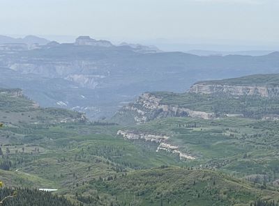
The Grand Staircase section of the Grand Staircase-Escalante National Monument is probably the most familiar section if you’re at all acquainted with this part of Utah. More than 6,000 vertical feet of slopes, cliffs, and terraces make up the “staircase”.
It extends approximately 150 miles (241 km) from the north rim of the Grand Canyon to the top of the Paunsaugunt Plateau directly west of Bryce Canyon National Park. Each “stair” is a cliff or slope as much as 2,000 feet high. Each plateau or terrace is as much as 15 miles (24 km) wide.
The origin of the name Grand Staircase is unknown but it’s easy to see where it came from. Great views of the entire staircase are few and far between. Perhaps the best is south of Kanab along Route 89A in Arizona.
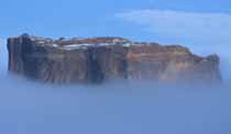
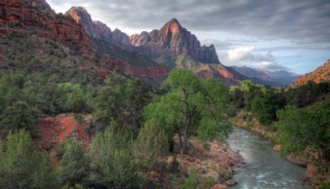
You can also see portions of the staircase east and north of Kanab. I actually took the photo above looking east from the road leading down from Cedar Breaks National Monument.
The Kaiparowits Plateau
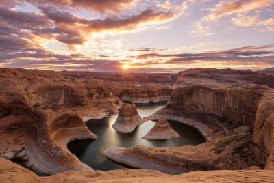
The Kaiparowits Plateau is a triangular-shaped section of the Grand Staircase-Escalante National Monument. Stretching over 50 miles (80.4 km) from the town of Escalante south almost to the Arizona border, the Kaiparowits Plateau is the highest part of the monument.
If you could see it from the air, you would see that the Plateau fans out southward from Escalante into an immense triangle. The triangle ends miles south at Lake Powell and the Paria Plateau. With over 800,000 acres, the Kaiparowits Plateau includes the most desolate, arid and remote parts of the monument.
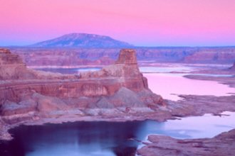
If you look north from the Glen Canyon National Recreation Area - Lake Powell – the skyline is dominated by Fifty Mile Mountain which is a prominent part of the plateau. It rises from Lake Powell nearly 4000 feet to an elevation of 7584 feet.
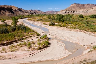
The northeastern edge of the plateau is defined by the Straight Cliffs - broad sandstone flats of the Escalante River. The western edge is bordered by the Paria River, Cottonwood Canyon and the Cockscomb.
The southern end of the plateau is carved deeply by tributaries of the Colorado River. These are now major branch channels of Lake Powell. The plateau covers an area of approximately 1650 square miles (4225 square km).
Southern Utah has been the backdrop for many environmental battles over the years. And the Kaiparowits Plateau was the subject of one of these battles. In 1965, the Southern California Edison Company wanted to build a 5000 megawatt coal-fired generation plant right in the middle of the plateau.
Fueled by the massive coal deposits in the plateau, more than 4 billion tons of fuel could have been produced by this plant. This would have produced electricity for the exploding populations of Los Angeles, San Diego and Phoenix.
What was seen by some in southern Utah to be a potential economic windfall met with increasing opposition from environmental groups and federal regulatory agencies.
This was right after many beautiful canyons were flooded by the Glen Canyon Dam and created Lake Powell so a lot of people were still upset. The proposal was dropped in 1975.
The Canyons of the Escalante
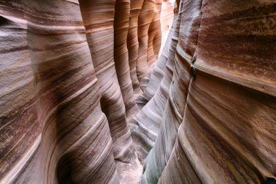
The Escalante Canyons include some of the most magnificent and wild terrain in America. Of course, you could say that about all three sections of the monument. To illustrate this point, the Escalante River was the last river in the continental United States to be named. It snakes lazily beneath towering canyon walls.
The Escalante’s tributaries flow by arches, through natural bridges and over waterfalls. It sounds a lot like Glen Canyon before Lake Powell flooded it. Some of the most extraordinary desert hiking in the west … for those who are prepared … is found in these canyons.
The Canyons are a part of a natural basin rising up to higher levels of the Colorado Plateau. The Colorado Plateau rises as high as 11,000 feet and drops to as low as 3,700 feet at Lake Powell.
Despite
the beauty of the region, let me repeat. It is a remote and dangerous area
for the unprepared. There are very few marked trails. Hardened and fit
visitors can expect a challenging and isolated adventure. But it isn’t suitable
for the unprepared or unfit.
What To See Nearby
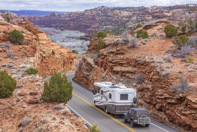
The road between Escalante and Torrey … 32 miles (52 km) long … has been described as the most scenic road in southeastern Utah. I’ve been on it and I believe this to be true. If I had to recommend only one thing you should experience in southern Utah, it would be to drive Scenic Byway 12.
Stretching more than 120 miles (193 km), Car and Driver magazine rates it one of the top 10 scenic byways in America. Passing through some of the most spectacular scenery anywhere, it lets you experience Red Canyon, Bryce Canyon National Park, and Grand Staircase-Escalante National Monument.
It takes you over Boulder Mountain in the Dixie National Forest and ends near the entrance to Capitol Reef National Park.
Within 100 miles of the town of Escalante at the north end of the monument are Zion National Park, Cedar Breaks National Monument, Glen Canyon National Recreation Area, Petrified Forest State Park, Anasazi State Park Museum, Kodachrome Basin State Park, and the Dixie National Forest.
How To Get To Grand Staircase-Escalante National Monument
Two paved roads give you access to the national monument. Highway 89 from the Kanab/Big Water area. And Highway 12 from the Escalante/Boulder area. All of the other roads are remote and undeveloped.
Hiking Grand Staircase-Escalante National Monument
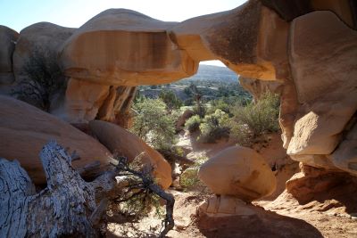
There are some fantastic hiking adventures in Grand Staircase-Escalante National Monument. Since there are only a couple roads leading into this area, one of the only ways to really see this amazing country is by hiking it. If you are fit, able, and prepared.
Whether you’re looking for a shorter day hike or a challenging multi-day adventure, you’ll be able to find solitude and scenery unlike anywhere else. And the sunsets are absolutely incredible.
Some popular hikes in the monument include Upper and Lower Calf Creek Falls, Escalante Natural Bridge, and some of the Hole-in-the-Rock Road hikes.
If you need some help to find your way around, there are top-notch professional guides available to help you explore this amazing land ... Grand Staircase-Escalante National Monument.
Have A Great Story About
Utah National Monuments?
Utah National Monuments?
Do you have a great story about this or any of Utah's National Monuments? Share it!


