That You Were Never The Same?
Bears Ears National Monument
Sacred Mesas, Cliff Dwellings and A
Modern Story Still Being Written
If you’ve delayed visiting Bears Ears National Monument because of some of the headlines over the years, I get it. I’ve delayed writing about it for the same reasons.
Since its inception, it’s been hard to even figure out exactly what it included. And, like always when it comes to public lands in central and southern Utah, politics always seems to raise its ugly head. Or heads.
Boundaries have shifted, lawsuits have been filed, politicians have made speeches and then commitments have been reversed. But in the monument itself … out among piñon and juniper with the San Juan River cutting its lazy curves … the land itself remains steady. No matter where someone decided to draw imaginary lines.
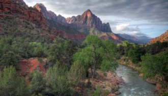
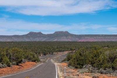
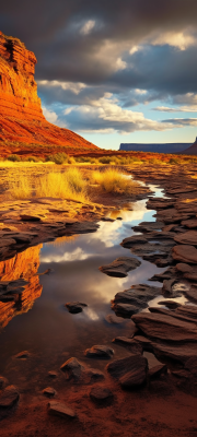
Sun warms red rock in the morning. Ravens ride the thermals. The peaks which give this national monument its name … Bears Ears … beckon in the distance. They are visible for miles in all directions.
Where It Is And What It Protects
Bears Ears National Monument is an immense swath of canyon country in Utah’s far southeast. It is anchored by the twin buttes that give the monument its name.
The monument stretches from Indian Creek (southwest of Moab) across Cedar Mesa and Comb Ridge toward the San Juan River. In between, there are thousands of archaeological sites tucked into alcoves and side canyons.
It is these sites that the initial boundaries were trying to protect. In the latest restructuring, the monument was restored to 1.36 million acres in October 2021.
Bears Ears National Monument is co-managed by the BLM, the U.S. Forest Service, and the five Tribal Nations of the Bears Ears Commission (Hopi, Navajo Nation, Ute Mountain Ute, Ute Indian Tribe, and Zuni).
The Controversy in Plain English
Here’s the short timeline which has shifted with the wind direction:
- Dec 28, 2016: President Obama established the monument at 1,351,849 acres and created a framework for tribal co-management.
- Dec 4, 2017: President Trump reduced it to about 201,876 acres split into two noncontiguous units (Indian Creek and Shash Jáa).
- Oct 8, 2021: President Biden restored the monument to 1.36 million acres and reaffirmed tribal co-management via the Bears Ears Commission.
- Aug 11, 2023: A federal judge dismissed Utah’s challenge to the restoration. The state appealed and arguments continue. The monument stands with its original acreage and is being actively managed under its restored boundaries.
The bigger milestone came in January 2025, when the BLM and Forest Service approved the final Resource/Monument Management Plan. It was the first of its kind.
It embedded Indigenous leadership and Traditional Knowledge throughout. It seems to now be the playbook for how this landscape will be cared for in the decades ahead.
What
This Means For Your Visit
The new plan doesn’t fence you out. I suppose it simply asks you to be a better guest. In the Indian Creek front-country, camping is moving to designated sites.
Existing dispersed spots while the agencies finish site-by-site designations. Fire pans (or metal rings where provided) are the norm.
Wood gathering is curtailed in sensitive areas. Pets need to be leashed. Climbers will see updated guidance to minimize impacts to raptors and cultural sites.
If you’re headed for Cedar Mesa canyons (Grand Gulch, Mule, Owl, Fish, Slickhorn and friends), know that backpacking permits are required. Moon House is the one day hike that also requires a limited permit.
It’s a simple system once you’ve done it. It is absolutely worth the planning. Then there’s the ethic that matters more than any rule: Visit With Respect.
Don’t touch the walls. Don’t move artifacts, even “just for a photo.” And definitely don’t remove anything even if you’re related to Indiana Jones. It is illegal.
Keep a respectful distance from rock art. Teach kids why this is sacred ground for living communities, not a playground.
If you’re new to this conversation, the Bears Ears Education Center in Bluff is the best 20-minute orientation you can give yourself before you head out.
How To Approach The Monument
(and Not Rush It)
Bears Ears isn’t a single loop road with a gatehouse. It is massive. The size and the inclusion of so much land is what made it so controversial right from the get-go.
The magnitude naturally results in the monument’s awe-inspiring diversity. It’s a quilt of mesas, washes, and side canyons stitched together by state highways and a lot of dirt in between.
Most travelers base out of Moab, Blanding, Bluff, or Monticello.
- Indian Creek Unit: From Moab, drive US-191 south about 40 miles and turn west on UT-211. The red walls rise immediately. World-class crack climbing is on your right and the road ends at the Needles District of Canyonlands. The late-day light here is special.
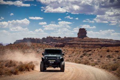
- Shash Jáa and Cedar Mesa: From Bluff or Blanding, take US-191 to UT-95 and fan out along UT-261 for Comb Ridge, Butler Wash, and Cedar Mesa trailheads. The best far-view of the Bears Ears Buttes comes from SR-261 as you drive north toward UT-95. You can also ease a high-clearance vehicle up Elk Mountain (FR008) to the saddle between the buttes when the road is dry.
If you only do one “Visitor Center”, make it the Bears Ears Education Center in Bluff (567 W. Main). Check hours ahead of time.
Edge of the Cedars State Park Museum in Blanding is the perfect second stop. It has an unmatched pottery collection and an interpretive kiva you can crawl into before you go looking for real ones.
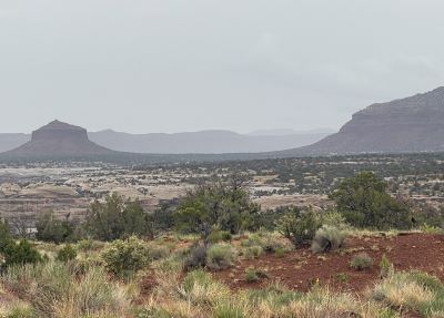
What Is There To Do In
Bears Ears National Monument?
You can walk short social trails to rock art panels you’ve seen in books. You will want to carry more water than you planned because the air is bone-dry and the distances fool you.
You might backpack a night or two in Grand Gulch. Even wade a cool trickle past sandstone alcoves and cottonwood shade.
On the San Juan River, you can float from Sand Island to Mexican Hat. Camp on sandbars between petroglyph galleries.
If climbing is your thing, Indian Creek’s cracks require a graduate level degree of competence. New stewardship norms take both raptors and historical significance into consideration.
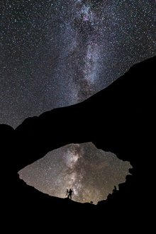
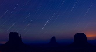
And on a clear night, you can lie on slickrock and try to find constellations that haven’t been named yet. These are some of the best night skies in the world out here.
If you want a starter loop with a little of everything … landscape, culture and big views … try this:
- Natural Bridges National Monument overlooks at golden hour (the Bears Ears rise on the horizon).
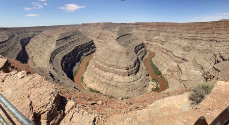
- Moki Dugway (UT-261) for the big drop off Cedar Mesa then Goosenecks State Park to peer over the San Juan’s entrenched meanders.
- A night in Bluff and a morning at the Bears Ears Education Center then up UT-95 to a Cedar Mesa trailhead for a short, respectful stroll to a cliff dwelling.
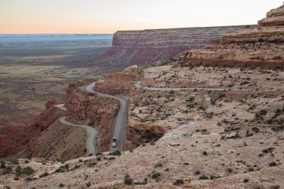
Bears Ears is Immense!
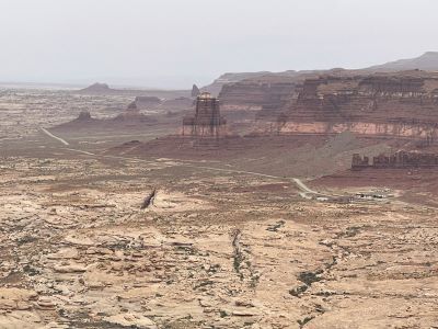
Be aware that Bears Ears National Monument, at times, never seems to end. We drove right through the middle of it from Hanksville to Blanding along UT-95. We were still driving in it the next day while headed towards Bluff and Mexican Hat.
After road-tripping through and around this immense area, I can understand some of the concerns that were raised by many Utah residents and politicians. Seems like a lot of land to designate as a federal National Monument.
Still, I didn’t see anyone living out here for hundreds of miles so apparently no one was displaced. The next time someone tells you how crowded the world is, try taking a drive through this area.
Seasons, Safety, and a Pace
That Feels Right
Spring and fall are prime times to visit this area of Utah. Cool mornings, warm afternoons, long clean light. Summer brings heat and monsoon bursts that turn clay roads to grease.
Winter can be crystalline and quiet though shaded ledges will hold onto ice. Services are spaced out.
Gas up in Moab, Blanding, Bluff or Monticello. Gas stations are few and far between. Carry more water than you think you need especially if you’re going to get out and hike.
Cell service out here comes and goes. It is always interesting to me where you pick it up and where you lose it. We’ve spotted cell towers located in some of the most remote places.
Downloading maps beforehand might be a good idea. The BLM’s “Know Before You Go” page is a quick reality check on heat, hydration, and sun exposure.
Why Visit Bears Ears National Monument?
Because the story is bigger than the politics. Bears Ears was proposed and is now managed with Tribal leadership at the table. This is not just a courtesy but as a matter of design.
The 2025 management plan puts that commitment in writing and in action. If you love Utah’s public lands, this is one of the most meaningful … and expansive … places you can spend a weekend. Or a week.
You get the canyons and stars you came for. You can also help prove that careful visitation and living culture can coexist on the same red rock.
We’ll be going back as we realized we could make a half dozen visits to Bears Ears and not visit the same area twice.
Have A Great Story About
Utah National Monuments?
Utah National Monuments?
Do you have a great story about this or any of Utah's National Monuments? Share it!


