Mexican Hat
Utah

Gateway
to Monument Valley and
Utah’s Canyon Country
Perched on the edge of the San Juan River in the far southeastern corner of Utah sits the small, quirky town of Mexican Hat Utah. It is not a big place by any means.
In fact, you can drive through it in under two minutes if you aren’t paying attention. But, despite its size, Mexican Hat has earned its place on the map as a key stop for travelers exploring some of the most dramatic landscapes in the American Southwest.
If you are heading toward Monument Valley, Goosenecks State Park or the scenic routes around Bluff and Valley of the Gods, chances are you will pass through Mexican Hat. And it is worth slowing down to take a look around.
We drove through Mexican Hat while making our way from Bluff and after having visited Goosenecks State Park. It was an interesting-looking little town and seemed to be the base for many adventures.
There were several businesses located there advertising rafting and river running services on the San Juan River. I thought it would be apropos to do a little research about it and add it to our road trip chronicle.
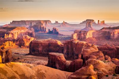
A Town Named After a Rock
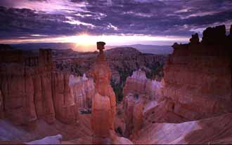
Mexican Hat Utah gets its name from an unusual rock formation that sits just outside town. It is a flat, sombrero-shaped boulder balanced precariously atop a sandstone spire.
Locals and geologists alike refer to it as simply the Mexican Hat Rock. It has become a roadside icon for this stretch of Utah. The formation is easy to spot from U.S. Highway 163.
There is a short, accessible dirt road that leads to the base if you want a closer look or a quick photo. One of those offbeat natural features that adds to the charm of the place … quirky, unexpected and somehow perfectly fitting in the rugged canyon country.
A Stop Along the Way... Or a Quiet Basecamp
Truth be told, Mexican Hat is less of a destination and more of a strategic stopover. But for some, that is exactly what makes it appealing. It is also used as home base for rafting or floating the nearby San Juan River.
My son-in-law told me this was the place they launched from when he floated the San Juan several years back. When we were standing at the overlook at Goosenecks State Park, we could see some rafts on the river far below us. They very likely launched from Mexican Hat or close to it.
With a permanent population hovering around 30 people on a busy day, Mexican Hat can be a suitable stopping point for road-weary travelers. It is also one of the last places to grab fuel, food, or a basic motel room before heading deeper into the wild corners of southeastern Utah and the Navajo Nation.
If you aren’t into big tourist towns or crowds, Mexican Hat might just be your kind of place to hang your sombrero for the night. We had stayed in Blanding so we were on our way south to Monument Valley and the Four Corners area. A quick look around and down the road we went.
Things to Do in And Around Mexican Hat
Let’s be honest. The biggest draw near Mexican Hat is Monument Valley Navajo Tribal Park. It is located just 20 miles south. I keep reading that Monument Valley is in Arizona but most of the points we wanted to see are in Utah.
Forrest Gump Point, The Mittens, the Visitor Center are all in Utah. I realize a large part of Monument Valley is in Arizona but not the parts we wanted to see.
The towering sandstone buttes and spires of Monument Valley are iconic symbols of the American West featured in countless films and photographs.
Staying in Mexican Hat puts you within easy striking distance of sunrise or sunset photo opportunities in Monument Valley and without the larger crowds of places like Kayenta or Page.
We did eventually head south to Kayenta before heading east to the Four Corners but there was nothing memorable about that town except a lot of road construction.
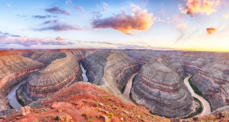
Just a 10-minute drive northwest of town is Goosenecks State Park, one of Utah’s most dramatic yet underrated viewpoints. Here, the San Juan River has carved a series of tight, meandering bends … known as entrenched meanders … into the desert floor creating a stunning 1,100-foot-deep canyon.
It is a simple, no-frills park with a parking area, a few campsites and million-dollar views. No hiking is required. Just walk to the edge and take it all in.
Valley of the Gods
Often called a "mini Monument Valley," Valley of the Gods lies northwest of Mexican Hat along a scenic, unpaved loop road. This 17-mile route winds through a landscape of towering sandstone buttes, mesas, and rock formations - all without the crowds or entrance fees.
The road is generally passable for most vehicles in good weather but check conditions before heading out especially after rain.
The San Juan River
Outdoor enthusiasts can also access the San Juan River near Mexican Hat. The stretch of river downstream from town is popular for rafting, kayaking and guided float trips offering a unique perspective of the surrounding canyons.
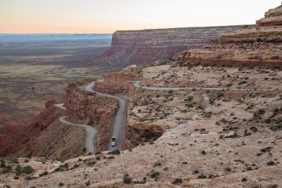
Photo - Travel Utah
Moki Dugway Scenic Byway
This road is a remarkable section of Utah Highway 261 where the road clings to the cliffs of Cedar Mesa. Hewn directly into the rock face, this rugged route links Highway 95 with US Highway 163. It offers another one of Utah's most memorable drives.
This dirt stretch is part of the Trail of the Ancients, a designated National Scenic Byway that highlights the archaeological sites and striking landscapes central to the ancient cultures of the Southwest.
The Moki Dugway is best known for its dramatic, winding switchbacks. These unpaved turns snake down 1,200 feet from the mesa's rim. Drivers will experience a breathtaking descent with grades approaching 10% over a three-mile stretch of gravel road.
Accommodations and Services
in Mexican Hat Utah
Mexican Hat, Utah keeps things simple. You will find a handful of motels, RV parks and small eateries including the quirky but well-known Swingin' Steak where dinner is grilled over a swinging steel grate in true Western fashion.
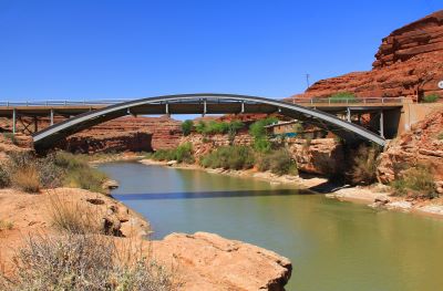
There is a gas station, a small convenience store and a few outfitters offering tours of the river or surrounding public lands. There is also an interesting bridge that takes you over the San Juan River … Jason R. Workman Memorial Bridge.
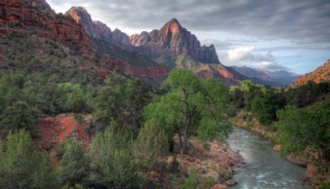
Beyond that? The rest is scenery … albeit awesome scenery … as the town is situated in a beautiful, red-rock encircled small valley.
A Place of Isolation and Big Skies
Part of Mexican Hat’s appeal is its remoteness. The town sits right along the Monument Valley to Bluff Scenic Byway and the San Juan River. It is surrounded by rugged desert landscapes, towering mesas and open sky.
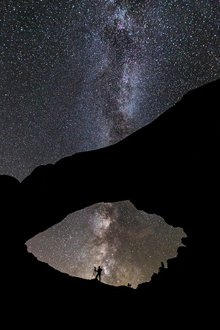
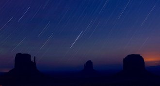
It is the kind of place where sunsets stretch on forever and where the stars blaze in the dark night sky. The traffic wasn’t heavy in early June and, I’m sure, fades to nothing once the sun goes down.
Practical Tips for Visiting Mexican Hat
- Services are limited: Stock up on essentials before getting there. Bluff, Utah (25 miles north) offers more options for food and fuel.
- Cell service: Spotty especially once you leave town in any direction.
- Weather: Summers are hot and dry. Winters can bring snow or ice to higher elevations nearby. On an early June day, the weather was perfect when we drove through it.
- Photography: Early morning and late afternoon light bring out the best in the red rock formations.
- Respect the land: Much of the area along the way is on Navajo Nation land. Be mindful of posted signs, private property and local customs. When traveling through Navajo land, always watch the speed limit signs. They tend to be lower on reservations.
Final Thoughts
Mexican Hat, Utah may not be a bustling tourist hub but for travelers exploring the dramatic canyon country of the Four Corners region, it is an interesting stop. Even if you don’t stop, it seemed to me to be a place I should know a little more about especially having heard the name many times.
Whether you spend a night, grab a meal or just pause to admire the namesake rock, Mexican Hat offers a quiet, authentic slice of Utah's rugged southern landscape.
Have A Comment or Story
About This Topic?
Do you have a comment or story about this article? Share it!


