That You Were Never The Same?
Big Cottonwood Canyon
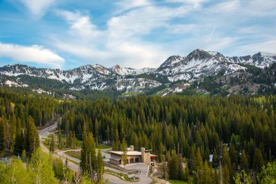
Quartzite Walls, Cool Creek Air
And a Straight Shot to Brighton’s High Country
The Big Cottonwood Canyon Scenic Byway climbs Utah SR-190 from the canyon mouth on Salt Lake City’s east bench to Brighton at the top. You’ll find Solitude tucked just below Brighton.
It runs almost parallel to its sister a few miles south … Little Cottonwood Canyon … but the feel is different here. Narrower walls of ancient quartzite, more creekside pullouts and a string of trailheads launch you straight into the heart of the central Wasatch.
A Quick Word About The Watershed
(Important and Enforced)
Big Cottonwood Canyon protects part of Salt Lake City’s culinary watershed. That means no dogs, no horses, and no swimming or wading in the creek or lakes.
It’s not about being grumpy. It’s about keeping drinking water clean. You’ll see signs at trailheads and rangers do check.
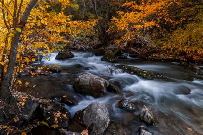
Storm Mountain - Where the Canyon Shows Its Teeth
Within minutes of leaving the valley, the road serpentines between towering, pink-gray cliff bands around Storm Mountain. Climbers still dot the walls during the warm weather months although it doesn’t seem like there are as many as there used to be.
Those slabs aren’t common granite. They’re Big Cottonwood Formation quartzite … sandstone that got pressure-cooked into hard, crystalline cliffs. In evening light, the faces glow and the amphitheaters feel like natural cathedrals.
I have many fond memories of the Storm Mountain area especially from my college days. We used to hold spring parties there when I attended the University of Utah. Keggers. My kids can’t believe we actually got away with those.
They were usually held on weekends after a scrimmage and right after spring football practice had ended for the year. Of course, these canyons were far less patrolled … and regulated … back then. And, far less crowded.
Fifteen Miles With Dozens of Places To Stop
The Big Cottonwood Canyon Scenic Byway is only 15 miles from the bottom of the canyon to Brighton Resort but it may take you all day if you let it. Nearly every mile offers a place to pull over. Some with tables. Some just a wide shoulder and a view.
Fishermen work undercut banks for trout. Cyclists grind steadily uphill toward cooler air. While photographers … these days armed with smartphone cameras … chase pockets of light up side gulches like Butler Fork, Mill D and Mill B.
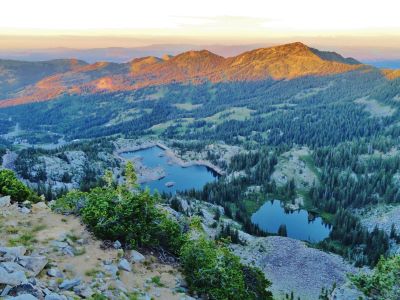
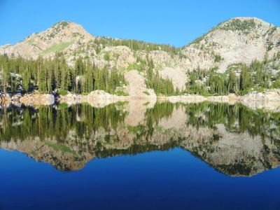
If you’re sampling the greatest hits, a few trailheads are hard to skip. Lake Blanche (Mill B South) is a stout climb to a postcard view of Sundial Peak mirrored in alpine water.
Donut Falls (Mill D South) is a family favorite when flows are moderate. We once drove our Jeep to the very top of this dirt road and came upon on old abandoned mine. A long time ago.
Butler Fork splits to Circle-All Peak or the Desolation Lake side. Both give you quick access to airy Wasatch Crest country.
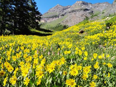
From Silver Fork you can wander meadows and old mine cuts that bloom with wildflowers in July. Up high at Brighton, short, stacked gems … Lake Mary, Martha, and Catherine, plus Twin Lakes … turn into a half-day loop with almost absurd scenery per mile.
Silver Lake: A Flat, Friendly Breather at The Top
While driving the Brighton loop, the road passes Silver Lake and its Visitor Center. There is a 0.8-mile boardwalk … level and stroller-friendly … which circles the lake meandering through willow marsh along the shoreline.
You’ll see waterfowl and even fish in the lake although it tends to get a little stagnant in late summer. In June the meadows hum with birds.
In October the aspens go full coin-gold. If you’re not set for a longer hike, this is the perfect “step out, breathe, and be here” stop.
If you want to hike further up the trails above Silver Lake, watch out for moose. We’ve encountered many along the trail. Although ordinarily peaceful, they are unpredictable especially with young ones nearby.
Ski Country That Doesn’t Sleep In Summer
Solitude Mountain Resort and Brighton Resort are winter anchors without a doubt. But summer and early fall are my favorite seasons up here. Lift-served mountain biking spins out of Solitude on select days.
Brighton’s upper basins turn into a meadow-and-lake sampler you could do every weekend and not get bored. Wildflowers peak around mid-July and the trails this high up seem relatively uncrowded as compared to those below.
Guardsman Pass: The Back Door To Park City
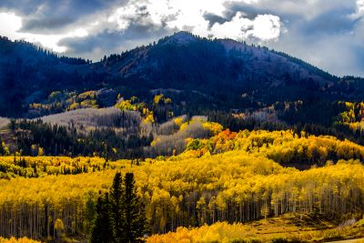
A mile below Brighton, a paved spur climbs over the mountain to Guardsman Pass and drops down to Park City. Or, if you take the right fork on the other side, into the Heber Valley via Midway. It’s fully paved, high and narrow in places but closed in winter with no snow removal.
One of our favorite drives as a stand-alone, late September can be spectacular along Guardsman. Whole hillsides of quaking aspens shift from lemon to amber with every gust of wind.
On busy fall weekends, arrive early. The pullouts fill fast and the morning light at the pass rewards the early riser. You can read more about Guardsman Pass here.
Seasons, Moods, and When To Go
Spring comes in bands … green at the mouth while the mountaintops are still white. Waterfall fans catch peak runoff in late May and June when the creek roars. The canyon wall sweat becomes ice climbs in winter.
Summer brings cool mornings, soft shade and higher temperatures that rarely feel oppressive. Fifteen miles up-canyon can be ten to fifteen degrees cooler than the valley below.
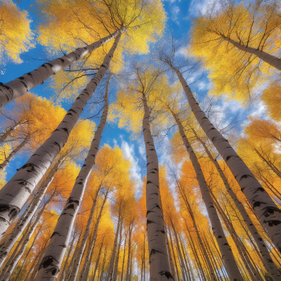
Fall is the showstopper. Maples blaze scarlet at lower elevations first while aspens … quakies as we’ve always called them … take over the color duty later in the fall.
Winter transforms the road into a corridor of snowbanks and avalanche paths. UDOT occasionally holds up traffic for avalanche control work. Traction laws kick in whenever storms threaten.
The traffic during winter has become unbearable due to the busy ski season. If you’re a skier, great. If not … like us … Big Cottonwood Canyon is best left untraveled in winter especially on weekends.
A Note On Sanity And Common Sense
Parking is finite and trailheads spill over quickly on summer weekends and peak color days. If a lot is full, keep going.
Shoulders are posted for a reason. They are narrow and emergency vehicles need the space. On some weekends, finding a parking spot may be a fantasy.
Pack out everything. Stay on trail in the alpine basins so the next set of wildflowers has a place to grow. And remember the watershed rules. Admire the water, photograph the water but don’t step into it.
Getting To Big Cottonwood Canyon Scenic Byway
From I-215, take the 6200 South/Canyons exit and follow signs east to SR-190. Drive past the gravel pit that has destroyed the mountainside at the canyon mouth and head up the canyon.
Almost immediately the city falls away. Cottonwoods crowd the banks, the road starts its meander, and that first bend below Storm Mountain resets your breathing.
It’s a drive I’ve done more times than I can count. On fall afternoons just before the first snow. On July dawns when the roaring creek sends up curtains of liquid air.
And on clear autumn mornings when sunlight filters through the golden shimmering quakies. It still feels new each time.
Big Cottonwood Canyon Scenic Byway isn’t a complicated byway. It’s a simple, beautiful climb that trades suburban traffic and crowds for high-country air in ten minutes flat (albeit often with seemingly similar crowds).
If you’ve got an hour, do Silver Lake and a picnic pullout. They are now charging $10 for a 3-day pass to park at the Silver Lake Visitor Center.
I’m all for it if the funds are used to keep the area clean and upgraded. The America The Beautiful National Park Pass is accepted. Just leave the pass in your window when you park.
If you’ve got a day, lace up for Lake Mary or Blanche and linger until the shadows stretch. Either way you’ll roll back down the canyon with the windows cracked and a reminder that the beckoning Wasatch are mere minutes from the masses below.
Have A Great Story About Utah's
Scenic Byways?
Do you have a great story about this or any of Utah's scenic byways? Share it!


