How Does a Super El Niño
Affect Utah's Weather?

Could The Winter of 2026–2027 Bring
Another One of Utah's Record Ski Years?
If you've been hoping for a big, snowy winter in Utah, I've got some encouraging news. The key may come from simply answering the question “How does a Super El Niño affect Utah's weather?”
Something extraordinary is happening thousands of miles away in the tropical Pacific Ocean. And it could have a major impact on Utah's weather this winter.
It's called a Super El Niño. And the one currently developing for the winter of 2026–2027 could become one of the strongest on record.
For skiers, snowboarders, and anyone concerned about Utah's persistent drought, that's welcome news. Some of Utah's snowiest winters have coincided with powerful El Niño events.
One produced a statewide snowpack record that stood for 40 years. Could we be looking at another winter like that?
Possibly.
Several winter forecasts suggest Utah could enjoy above-normal mountain snowfall particularly from January through March. So, how does a Super El Niño affect Utah's weather?
What happened during previous El Niño years? And what might we reasonably expect this winter?
Let's look at the history, the science, and some surprisingly encouraging forecasts.
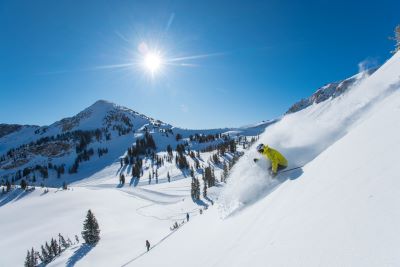
Image - Travel Utah
What Exactly Is a Super El Niño?
El Niño is a recurring weather phenomenon caused by unusually warm sea surface temperatures in the central and eastern tropical Pacific Ocean.
It is part of a larger natural climate cycle called the El Niño-Southern Oscillation or ENSO. Its opposite is La Niña when ocean surface temperatures in the same region become cooler than normal.
These changes might seem insignificant when you're sitting in Salt Lake City watching the snow fall. But they influence weather patterns throughout all of North America.
During El Niño, warmer waters alter atmospheric circulation and influence the jet stream. That is the fast-moving current of air that helps steer storms across the continent.
The southern branch of the jet stream often becomes more active directing Pacific storms into southern California, Arizona, New Mexico, and parts of the Mountain West.
That can mean more winter precipitation including heavy rain at lower elevations and significant snowfall in the mountains. Utah sits between the regions that typically receive more moisture and those that often experience drier conditions.
That's why El Niño doesn't affect every part of Utah equally. But during particularly powerful events, the potential for a much wetter winter increases.
So what makes an El Niño super?
The term isn't an official NOAA classification. It's a popular description for an exceptionally strong event generally associated with tropical Pacific temperatures running at least 2 degrees Celsius above normal.
During such events, the warmer waters can dramatically influence storm tracks and global temperatures. And that brings us to this winter.

The Super El Niño of 2026–2027
Could Be Historic
According to the National Oceanic and Atmospheric Administration (NOAA), the El Niño developing this winter has already reached remarkable strength.
In its November 12, 2026 update, NOAA reported that temperatures in the important Niño-3.4 region of the Pacific had climbed approximately 2.5 degrees Celsius above average.
In portions of the eastern Pacific, anomalies exceeded 4 degrees Celsius. Those are substantial departures from normal.
NOAA now estimates a greater than 79% probability of a strong-to-very-strong El Niño continuing through January–March 2027.
Even more interesting, its latest forecast suggests roughly a 60% chance that the event could reach historically exceptional strength during the late-fall and early-winter periods.
That's eye-opening.
It doesn't guarantee a record-breaking snow season in Utah. But it means we're dealing with an unusually powerful climate pattern capable of significantly influencing winter weather.
And after Utah's exceptionally dry winter of 2025–26, the timing couldn't be better.

What Happened During Utah's
Previous Super El Niño Winters?
Here's where things get particularly interesting.
Several of Utah's most memorable snow years have occurred during powerful El Niño events. But not every Super El Niño produces the same results.
And there's another distinction worth understanding. Total snowfall and mountain snowpack aren't the same thing.
Snowfall measures how much snow actually falls. Snowpack measures the snow accumulated on the ground often expressed as the amount of water it contains.
Both matter to skiers. But snowpack is especially important to Utah's water supply.
Let's look at four previous winters and what they tell us.

The Winter of 1982–1983: One for the Record Books
If you've lived in Utah as long as I have, then you’ll remember the winter of 1982–83. It was extraordinary.
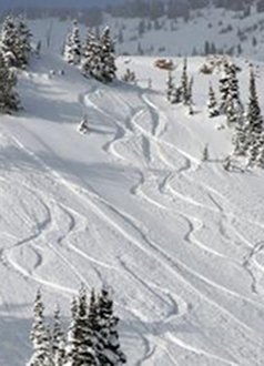
During one of the strongest El Niño events of the twentieth century, a succession of powerful storms buried Utah's mountains under enormous amounts of snow. Alta Ski Area recorded approximately 687 inches during the season. That's more than 57 feet!
And the statewide snowpack reached 26 inches of snow water equivalent. That was a record in the modern SNOTEL monitoring system that stood until 2023.
Snow continued accumulating late into spring. For skiers, it was an unforgettable season. For communities along the Wasatch Front, however, that enormous snowpack eventually created serious problems.
When temperatures rose sharply in late May, rapidly melting snow produced widespread flooding. Parts of downtown Salt Lake City were inundated.
State Street became a temporary river as city workers directed run-off down the middle of the street and then redirected it west along 1300 South. Other Utah communities experienced significant flooding.
The mountains up Spanish Fork Canyon literally shifted due to the water-logged soil eventually inundating the old ghost town of Thistle. U.S. Route 6, and the entrance to U.S. Route 89, had to be repositioned and rebuilt as they were buried under tons of saturated mountainside.
That winter demonstrated just how much moisture Utah's mountains can accumulate when favorable storm patterns persist. It also showed that a big snow year can bring challenges when spring arrives.
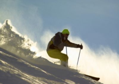
The Winter of 1997–1998: Another Powerful El Niño
The winter of 1997–98 brought another historically strong El Niño. Once again, Pacific storms delivered exceptionally wet conditions to California and portions of the Southwest.
Utah benefited, too. Salt Lake City received considerably more winter precipitation than normal during the December-through-February period.
Statewide mountain snowpack finished above average. Alta recorded approximately 660 inches of snowfall that season. That wasn't a record but it was still an impressive winter.
The important point is that two exceptionally powerful El Niño events, 1982–83 and 1997–98, coincided with substantial mountain snowfall in Utah.
And the current El Niño could … emphasis on could … rival those historic events in strength.

Photo: Travel Utah
The Winter of 2015–2016: A Different Outcome
Then there’s the 2015–16 El Niño which was among the strongest on record. But Utah didn't experience anything comparable to 1982–83.
Mountain snowpack was much closer to normal and the expected extraordinary snowfall never materialized statewide. Some ski resorts enjoyed good skiing but it wasn't the remarkable season many had anticipated.
That's the limitation of relying entirely on El Niño. Other atmospheric conditions still determine where individual storms travel.
Even the strongest El Niño can't guarantee a big winter in Utah.

Photo: Travel Utah
The Winter of 2023–2024: A More Recent Example
The 2023–24 winter also occurred during El Niño conditions. While it wasn't a record-setting statewide season, Utah's mountains enjoyed a nice snow year.
Alta recorded 628 inches of snow with an especially active period from January through March. In fact, according to Alta's season recap, more than three-quarters of its in-season snowfall occurred between January 4 and March 31.
That's an interesting comparison with this winter's forecasts which also favor the January-through-March period. If we got what we got two years ago, that would make a lot of skiers, and Utahns, happy.
Especially since that winter gave us nice snowfall in the mountains but not an extensive amount in the city below due to the warm temperatures.
What About Utah's Incredible Winter of 2022–2023?
Here's an important detail. Utah's record-breaking winter of 2022–23 occurred during La Niña conditions, not El Niño.
Statewide snow water equivalent peaked at 30 inches or 216% of normal. That smashed the previous modern record of 26 inches set in 1983.
Alta recorded an astonishing 903 inches of snowfall which was its highest seasonal total in the resort's published records.
So Utah's two biggest statewide snowpack years in the modern SNOTEL record occurred during different ENSO phases!
The lesson? Utah can enjoy an extraordinary winter under several different weather patterns.
But the 1982–83 season proves that a powerful El Niño can accompany one of the snowiest winters our state has ever experienced.
And that's an encouraging comparison for 2026–27.
What Are the Forecasts for Utah's
2026–2027 Winter?
This is where things get particularly interesting for skiers.
NOAA's broad seasonal outlook doesn't promise above-normal precipitation everywhere in Utah. Southern Utah generally has a more favorable position within the traditional El Niño storm pattern.
But some specialized ski-weather forecasts are considerably more optimistic. OpenSnow, a forecasting service widely followed by skiers and snowboarders, examined historical Super El Niño winters and identified encouraging snowfall signals across Utah.
Its 2026–27 outlook favors above-normal mountain snowfall, particularly from January through March. That includes well-known northern Utah destinations such as Alta, Snowbird, Brighton, Solitude, Snowbasin, and Park City.
Interestingly, OpenSnow identified Park City as having one of the stronger historical relationships with above-average snowfall during the most powerful El Niño events.
That doesn't mean Park City will receive more snow than Alta or Snowbird. It just means Park City's snowfall has responded favorably during some of the strongest El Niño winters.
Southern Utah also looks promising. Brian Head Resort and the surrounding mountains have historically shown favorable snowfall levels during powerful El Niño episodes.
There's an important distinction here. Salt Lake City's valley snowfall may be below normal even while the nearby mountains receive above-normal snowfall.
That's because strong El Niño winters often bring warmer-than-average temperatures increasing the possibility of valley rain while mountain elevations receive snow.
For skiers, that's not necessarily bad news. It's the snow accumulating above the resorts that matters most.

Which Months Could Bring Utah's
Heaviest Snowfall?
If you're planning a ski vacation this winter, pay particular attention to January, February, and March. Historical comparisons suggest those months offer some of the most encouraging prospects during strong El Niño winters.
November and December: Building the Foundation
Early-season storms establish the foundation for winter skiing. And we're already seeing some encouraging activity.
As of mid-November, a series of Pacific storms is moving toward Utah with mountain snow expected and additional systems potentially following. In fact, we’ve already experienced several storms with multiple days of rain in the valleys and snow in the mountains.
It’s already a far cry from last year.
The National Weather Service has forecast accumulating mountain snow during this period although actual totals will depend on individual storm tracks and temperatures. That's an encouraging start.
In the past, November and December have been unpredictable. Some years have brought substantial early snowfall. Others didn’t really get going until January.
Again, it seems that we’re off to an encouraging start already. For early-season visitors, checking current resort conditions is far more useful than relying on a seasonal forecast alone.

January: The Snowfall Pattern Could Strengthen
January is where the optimistic outlook becomes especially interesting. By then, the Pacific storm patterns associated with El Niño may be well established.
If those storms repeatedly track into Utah, January could deliver significant mountain snowfall and an increasingly deep snowpack. That's exactly what skiers want.
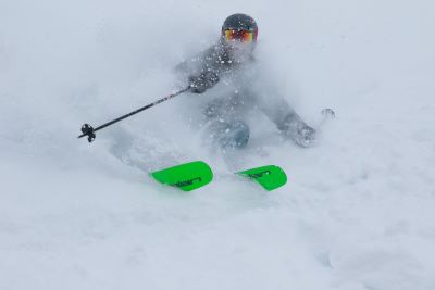
And when cold air accompanies the storms, Utah's famous dry powder can be spectacular.
Another positive aspect of frequent storms is that our depressing valley inversions don’t have a chance to really gain momentum before the next storm blows them out.
February: A Promising Month for Powder
February may be one of the best months to consider for a Utah ski trip. By then, the mountains typically have an established snow base and temperatures at higher elevations remain cold enough to preserve good conditions.
If the active storm pattern continues, fresh snow could accumulate on top of an already substantial base. Of course, an individual February week can still be dry.
But for visitors planning well in advance, this looks like a particularly appealing month. See my article here that talks about how, historically, so many of our biggest storms hit in February.
March: Don't Overlook Late-Winter Skiing
March could be just as interesting. Utah's snowpack typically continues building into late March or early April depending on elevation and weather.
And some of our biggest storms arrive late in the season. During the remarkable 1982–83 winter, snow continued accumulating well into spring.
We’re certainly not predicting another 1983. But history shows that a persistent storm pattern can deliver excellent skiing long after winter officially ends.
For visitors who enjoy longer days, sunshine, and the possibility of major spring snowstorms, March may be an outstanding choice.
Your preferred window for a Utah ski vacation this winter would be late January through March.
That's not a guarantee of powder on any particular day. It's simply the period that best matches the encouraging historical outlook.

Will Northern Utah or Southern Utah
Get More Snow?
El Niño doesn't affect every part of Utah the same way. During a typical El Niño winter, the southern jet stream becomes more active increasing the potential for winter precipitation across the Southwest.
That often favors southern Utah. But northern Utah's mountains can also benefit particularly when Pacific storms travel farther north or arrive from favorable directions.
Northern Utah: Plenty of Reason for Optimism
Northern Utah's ski resorts are famous for receiving massive amounts of natural snowfall. Alta and Snowbird benefit from their elevation and favorable terrain in Little Cottonwood Canyon.
Brighton and Solitude, in Big Cottonwood Canyon, also receive substantial snowfall during a typical winter. Snowbasin, Powder Mountain, and the Park City resorts have their own advantages depending on storm direction.
The optimistic OpenSnow forecast favors above-normal snowfall throughout much of northern Utah's ski country.
There is one potential complication. Strong El Niño winters often bring warmer-than-average temperatures.
That can mean higher snow levels with rain falling at lower elevations while the upper mountains receive snow. Of course, that doesn’t bother those of us who live in the valleys below.
Big snow in the mountains and not-so-much in the valleys is my ideal winter. Even so, Utah's highest ski terrain is well positioned to benefit from colder temperatures at elevation.

Image - Travel Utah
Southern Utah: Perhaps the Biggest Beneficiary
Southern Utah may have an even stronger reason to welcome this El Niño. The region lies closer to the southern storm tracks that frequently become more active during powerful El Niño winters.
That increases the potential for additional precipitation across southern Utah's mountains and desert country. Brian Head Resort, with its high elevation, could be particularly well positioned.
Meanwhile, lower elevations may receive badly needed rain. For southern Utah's drought-affected landscapes, that could be excellent news.
And if the winter brings significant snowfall to the region's mountains, spring runoff could help replenish rivers and reservoirs.
Image - Travel Utah
Could This Super El Niño
Help End Utah's Drought?
This may be the most important question of all. Utah entered the 2026–27 water year in exceptionally poor condition.
The previous winter produced the state's lowest recorded snowpack. Snow water equivalent peaked at just 8.4 inches on March 9, 2026.
That's roughly half of normal. As the new water year began in October, statewide reservoir storage averaged about 50% of capacity, approximately nine percentage points below normal for that time of year.
And according to Utah water officials, the entire state remained in some category of drought. That's serious. But a particularly wet winter could make an enormous difference.
Utah's mountains function as natural reservoirs. They store frozen precipitation throughout winter, then gradually release it as snow melts during spring and early summer.
That runoff feeds our streams, rivers, reservoirs, and agricultural water supplies. A deep snowpack could improve streamflows, replenish reservoirs, restore soil moisture, and reduce drought severity across much of the state.
There's one complication. After prolonged drought, the ground can become exceptionally dry. Some of the first melting snow gets absorbed into the soil rather than flowing into reservoirs.
That means one big winter won't necessarily erase several years of drought. But a winter resembling 1982–83 or 2022–23 would certainly be a tremendous help.
And given what we've experienced recently, even a substantially above-normal snow season would be welcome.
What Could This Mean for Lake Powell
And the Colorado River?
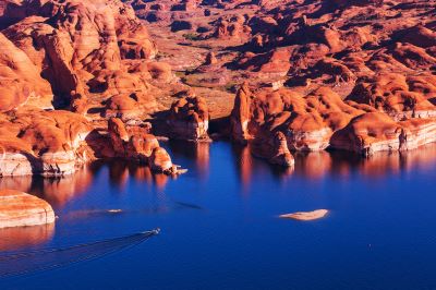
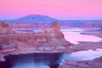
Lake Powell is another reason to follow this winter closely. This man-made reservoir depends heavily on spring snowmelt from the Upper Colorado River Basin, including large portions of Colorado, Wyoming, and Utah.
After years of drought, Lake Powell remains dangerously low. In November 2026, it contained only about one-quarter of its total storage capacity.
A wet winter across the upper basin could improve spring runoff and help replenish the reservoir. But there's an important catch.
An El Niño winter that brings substantial precipitation to southern Utah doesn't necessarily guarantee heavy snow in the headwaters of the Colorado River. Parts of the Northern Rockies and northern Mountain West can actually experience drier conditions during El Niño.
That's why snowfall in western Colorado, eastern Utah, and southwestern Wyoming will be particularly important. If those high-elevation watersheds receive substantial snow, the benefits to Lake Powell could be considerable.
A single wet winter won't solve the Colorado River's long-term problems. But it could provide badly needed relief.
Could Utah Actually Get
Too Much Snow?
After several dry years, that might sound like a wonderful problem. For skiers, it often is.
But the winter of 1982–83 reminds us that extraordinary snowfall can also create challenges.
- Heavy mountain snow increases avalanche danger particularly during intense storms or when unstable layers develop within the snowpack.
- Road closures and travel restrictions can affect access to some ski resorts.
- When spring arrives, rapidly melting snow can cause flooding.
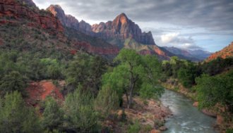
Southern Utah faces a somewhat different concern. Heavy rain can produce flash flooding in desert washes, slot canyons, and other low-lying areas.
That doesn't mean you should avoid Utah's outdoor attractions. Quite the opposite.
Utah remains a fantastic place to ski, hike, mountain bike, fish, and explore throughout the year. Just pay attention to weather forecasts, road conditions, and local safety advisories.
And remember that a wetter Utah usually means an extraordinarily beautiful Utah.

So, How Does a Super El Niño
Affect Utah's Weather?
After looking at the historical records and current forecasts, we can see several good reasons for optimism. We're experiencing a genuinely powerful El Niño that could become one of the strongest in recent decades.
- Some of Utah's most memorable winters, including 1982–83 and 1997–98, coincided with exceptionally strong El Niño events.
- Specialized ski forecasts favor above-normal mountain snowfall this winter particularly from January through March.
- And southern Utah appears especially well positioned to benefit from the wetter storm patterns frequently associated with El Niño.
Of course, there are no guarantees. The 2015–16 winter demonstrated that even a Super El Niño can produce disappointing results in Utah.
Warmer temperatures could mean more valley rain and occasionally higher snow levels at some resorts. Still not a bad thing in my book.
We shouldn’t dismiss the encouraging evidence simply because nobody can guarantee the outcome. The winter of 1982–83 showed what can happen when powerful Pacific storms repeatedly deliver moisture into Utah.
And the record-breaking winter of 2022–23 reminded us just how quickly our mountains can accumulate extraordinary amounts of snow when conditions line up.
Could 2026–27 become another memorable winter? We don't know yet.
But with one of the strongest El Niño events in decades developing, and with several encouraging forecasts pointing toward above-normal mountain snowfall, there's certainly reason to be excited.
For Utah's skiers and snowboarders, this could be a particularly rewarding season. And for a state badly needing relief from drought, a big winter would be welcome news indeed.
Here's hoping for deep powder, full reservoirs, and a badly-needed great Utah winter.


Bryce Canyon National Park
Canyonlands National Park
Wasatch Mountains
Lake Powell
Zion National Park
Arches National Park
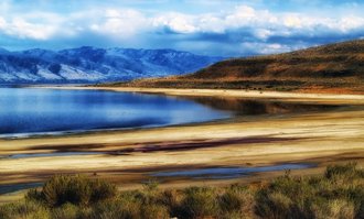
Great Salt Lake

Monument Valley