Book Cliffs
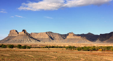
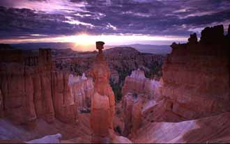
In the remote eastern part of the state, the 2000-foot cliffs will astound you when you first see them. Although remote, you’ll find a trip to the cliffs will provide a wide array of outdoor activities.
They begin about 50 miles south of Vernal. And extend south to the Book Cliffs Divide. To the east, lies the Utah/Colorado state line.
The Uintah and Ouray Indian Reservation is located on the west side. The cliffs are found in southern Uintah County and northern Grand County.
Why the Name?
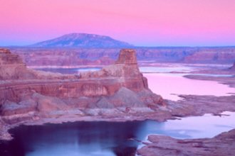
They also lie ... for the most part ... along the southern and western edge of the Tavaputs Plateau. The cliffs are largely composed of sedimentary materials with Cretaceous sandstone cliffs and south facing buttes.
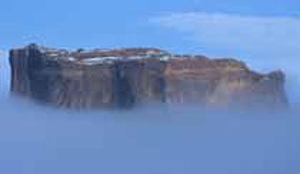
Some people think they were given the name because they give the appearance of open books standing on their sides on top of a table.
The BLM, hunters, and biologists use the name to cover this whole area even though a lot of the area is nowhere near the so-called cliffs. The altitude ranges from 4,500 on up to 8,000 feet. And this varied altitude creates a number of different climates and conditions.
Are The Book Cliffs in Danger?
Yet this beautiful part of creation is unfortunately … as usual … being marred by man. Facing increasing encroachment from oil, gas, and tar sand development.
The cliffs are rich in a variety of natural resources both renewable and non-renewable. The area has become a hotbed of activity due to vast quantities of oil, natural gas, oil shale, and tar sands as well as sand and gravel.
The development of these resources has scarred the landscape with oil rigs and drilling stations. In fact, some people believe these oil and gas drilling rigs are actually decreasing the natural value of this wild area.
They are scaring away wildlife and rapidly depleting the natural resources of the region. While destroying the terrain.
If You Love Wildlife, Visit This Area
The Book Cliffs have been renowned as one of the best hunting destinations in the country. Especially for mule deer and elk . Antelope are common and many people have seen Rocky Mountain bighorn sheep , and moose . There’s also a herd of more than 250 bison on the nearby Uintah and Ouray Reservation.
The unique terrain of the cliffs has made this region the home of approximately 7,500 mule deer. And a limited entry tag into this area has been coveted by many hunters both in-state and out.
Cougar, black bear, golden eagle, and hawk are numerous. As are owls, shorebirds, waterfowl, sage and blue grouse, and pronghorn antelope. The sheer number of animals and birds found in the region make it a fantastic place for bird and wildlife watching.
The Book Cliffs present a host of other outdoor and recreation activities including hiking , camping, off-roading, and more.
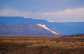
I’ve been out in the middle of the Book Cliffs several times. Quite a few years ago to hunt mainly. I remember taking a desolate dirt road from where the pavement ends south of Vernal. 45 miles into the heart of the cliffs. Seep Ridge Road.
And there were mule deer everywhere.
There were few oil rigs the last time I was there. Driving past rotting log cabins and deserted homesteads. Eerily remote. The primitive road being the reason so few people ventured into the heart of this region.
But this road ... winding past natural gas wells and oil rigs ... is the gateway to the virtually untapped resources of the Book Cliffs.
Why A Paved Road?
Up until the recession hit a couple years ago, tent and trailer “towns” had sprung up all over the region to house those working the rigs. The road is still dirt but that may be changing. Now Uintah County wants to pave it.
With thousands of gas wells to the west. And immense tar sand and oil shale deposits to the east. There’s only a dirt road to traverse the terrain. A paved thoroughfare would bring countless people into the area. From pipeline workers to sight-seers.
Lovers of wildlife ... and mule deer in particular ... fear for the fate of this area. The development ... some say destruction ... of this beautiful area could and probably would devastate the deer herd as well as so much of the other wildlife habitat.
The Seep Ridge Road is the result of an old idea to link Vernal to I-70 in Grand County. That original plan would have meant a very expensive descent into one of the canyons of the Book Cliffs.
Uintah County says they only want to pave to the county line. But Grand County doesn’t want the road to extend into their county.
The world-wide recession has slowed the development of the area but not halted it. The fate of the cliffs remains to be seen.


